
Figures & data
Figure 1. Location map of the study area: (a) East African countries with elevation background (b) the Lake Tana basin and its four major watersheds.
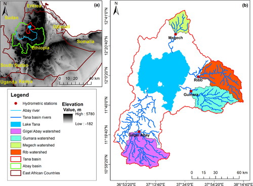
Table 1. Major watershed characteristics of the Lake Tana Basin.
Table 2. Discharge-sediment rating curve constants developed by Ministry of Water and Energy using power equation (S = aQb where S is sediment yield in t ha−1yr−1 and Q is discharge in m3 s−1).
Table 3. Geomorphometric characteristics of the watershed and methods for assessing the variables.
Figure 2. Stream orders, drainage lines and shapes of watersehds: (a) Gilgel Abay (b) Gumara (c), Rib, and (d) Megech.
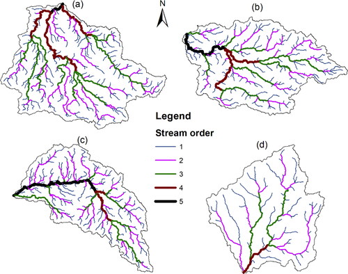
Figure 3. Aspect map of watersheds: (a) Gilgel Abay (b) Gumara (c), Rib, and (d) Megech.
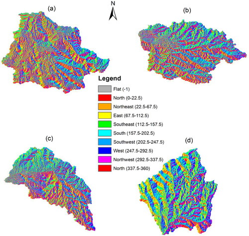
Table 4. Parameters of basin geometry and linear aspect for Gilgel Abay, Gumara, Rib and Megech watersheds.
Figure 4. Relationship of the length of overland flow versus 1st order stream number (blue) and stream length (orange).
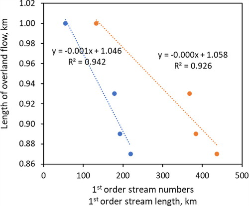
Figure 5. Drainage density map of watersheds: (a) Gilgel Abay (b) Gumara (c), Rib, and (d) Megech.

Table 5. Aspect and relief morphometric parameter values of studied watersheds.
Figure 6. Relative relief map of watersheds: (a) Gilgel Abay (b) Gumara (c), Rib, and (d) Megech.
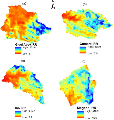
Figure 7. Ruggedness index map of watersheds: (a) Gilgel Abay (b) Gumara (c), Rib, and (d) Megech.
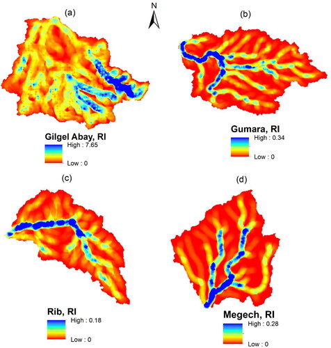
Table 6. Correlation matrix for geomorphometric parameters of the four major watersheds of Lake Tana basin.
Table 7. Prioritization of the four watersheds using geomorphometric parameters.
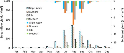
Table 8. Daily minimum, maximum, and mean streamflow and suspended sediment concentration as well as mean annual streamflow and sediment yield of the studied rivers.
Figure 8. Mean annual streamflow and sediment yield of the studied watersheds.
Data availability statement
The raw data required to reproduce the above findings are available to the corresponding author Dr. Anwar A. Adem ([email protected]) on reasonable request.