
Figures & data
Figure 1. Flowchart of the methodology used in this work.
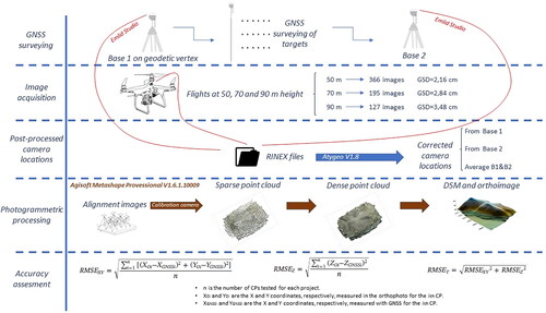
Figure 2. Location of the study area. Coordinates are referred to UTM Zone 30 N (European Terrestrial Reference System 1989, ETRS89).
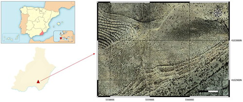
Figure 3. Morphology of the study zone.
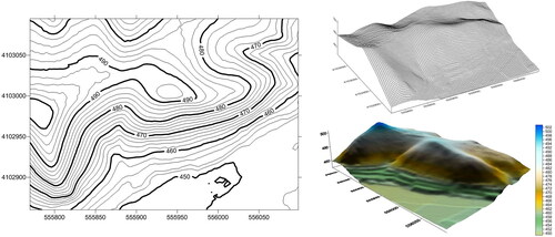
Figure 4. (a) Geodetic vertex of the REGENTE Network, named Bardinales; (b) Example of static target measurement for this work.
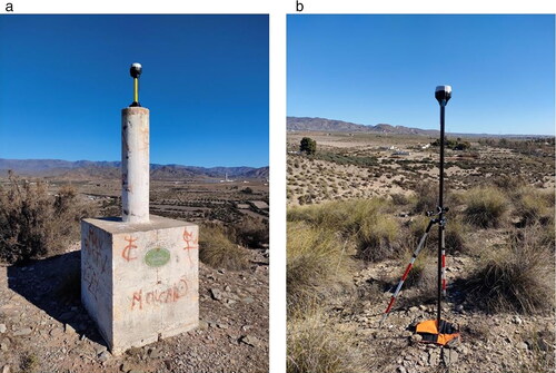
Figure 5. Final disposition of the control targets used in this work and of the two fixed base stations.
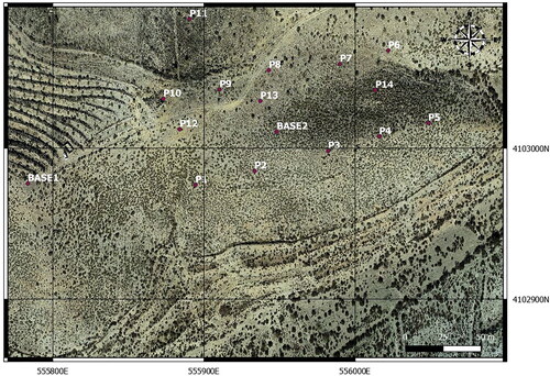
Figure 6. Example of the route followed by the drone for the 50-m height flight.
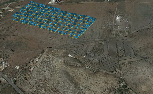
Table 1. Summary of photogrammetric projects carried out.
Figure 7. Planimetric error obtained in photogrammetric projects.
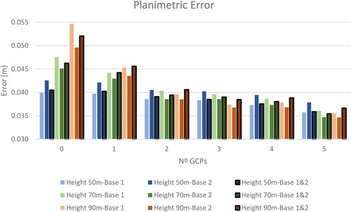
Figure 8. Altimetric error obtained in photogrammetric projects.
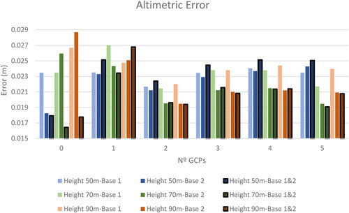
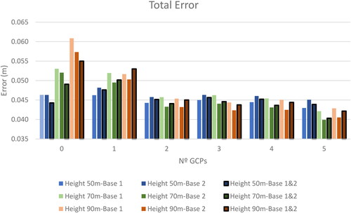
Figure 9. Total error obtained in photogrammetric projects.
Data availability statement
The data that support the findings of this study are openly available in “figshare” at 10.6084/m9.figshare.19509961 reference number.