
Figures & data
Figure 1. Geographical location and sampling point distribution in the study area (Planet).
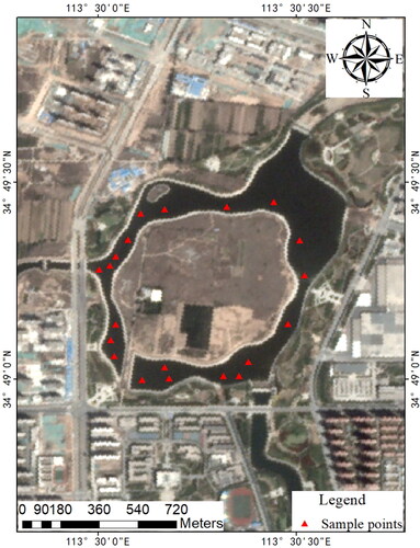
Figure 2. Measured spectral data.
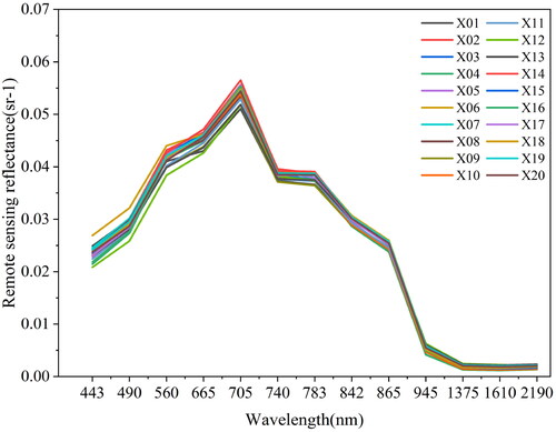
Figure 3. Technical roadmap.
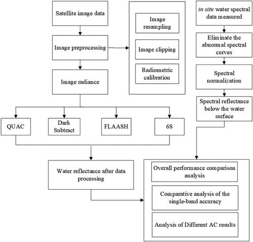
Figure 4. Scatter plots of remote sensing reflectance data after AC and reflectance of measured data.
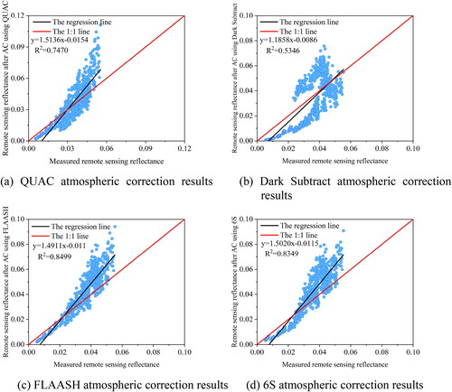
Figure 5. Accuracy comparison of each band after AC.
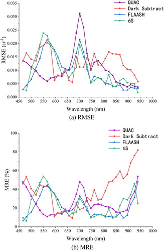
Figure 6. Remote sensing data reflectance after AC and the reflectance of measured data.
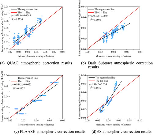
Figure 7. Accuracy comparison of each band after AC.
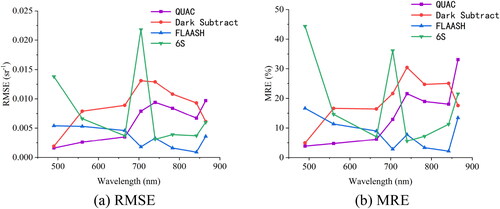
Figure 8. Remote sensing reflectance after AC and reflectance of measured data.
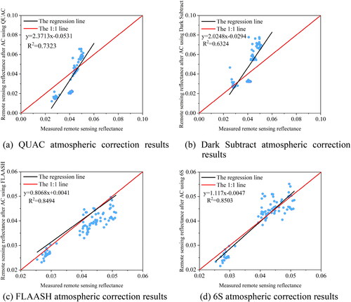
Figure 9. Accuracy comparison of each band after AC using different methods.
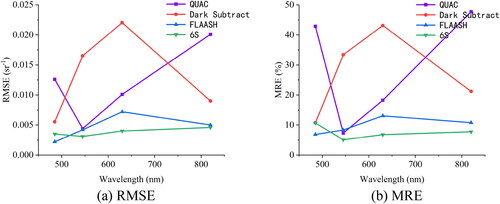
Figure 10. Remote sensing data reflectance after AC and reflectance of measured data.
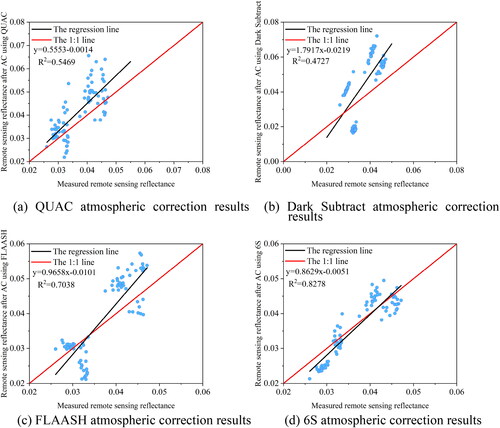
Figure 11. Accuracy comparison of each band after AC using different methods.
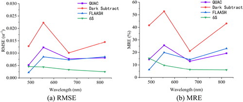
Table 1. Comparison of AC results from four types of satellite data.