Figures & data
Figure 1. Methodological flowchart of the review.
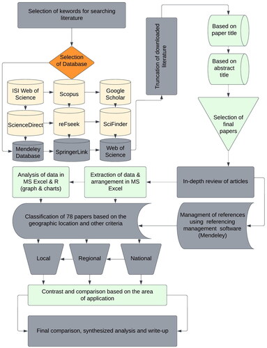
Figure 2. Matched pair of different parameters of SAR images.
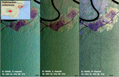
Figure 3. Spectral resolution = ability of a sensor to separate individual wavelength ranges (channels or bands) (https://landsat.gsfc.nasa.gov/).
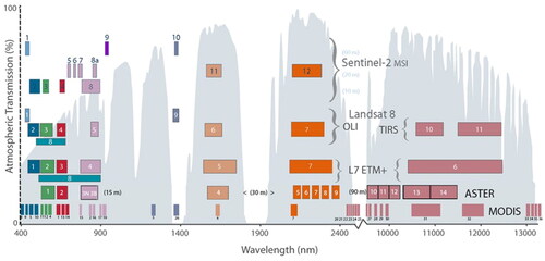
Figure 4. The geographical locations of 78 studies reviewed from (1998–2022) laid across the globe on the use of SAR and optical imagery to assess land cover change (LULCC) and land degradation.
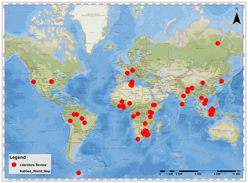
Figure 5. Distribution of study scale against each year (1998–2022).
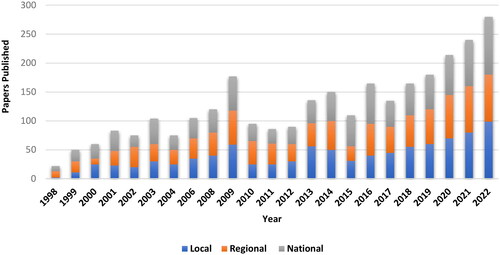
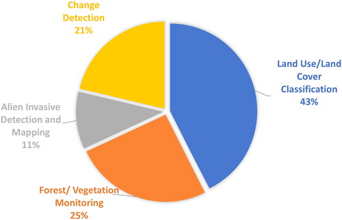
Figure 6. Percentage of the application of remote sensing for the 78 reviewed studies.