
Figures & data
Figure 1. Design research methodology for external package design.

Table 7. Recurring data and associations in spatial planning systems.
Figure 2. Transformation of sectoral policies into spatial plan.
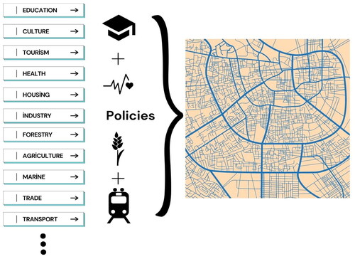
Table 1. Spatial plan decision types in literature studies.
Table 2. Germany spatial planning system specifications.
Table 3. Canada spatial planning system specifications.
Table 4. Turkey spatial planning system specifications.
Table 5. Japan spatial planning system specifications.
Table 6. England spatial planning system specifications.
Figure 3. Spatial planning system package overview.
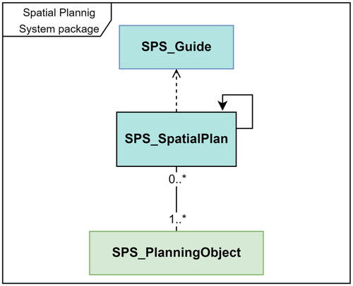
Figure 4. Spatial planning system package UML classes and associations.
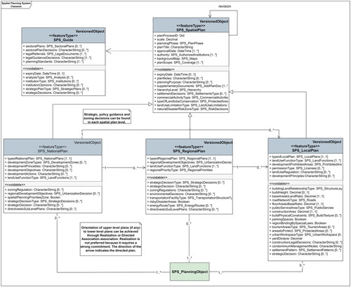
Figure 5. Associating SPSDM and LADM classes.
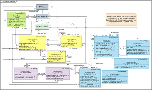
Figure 6. Objects to which the proposed SPSDM classes correspond in the planning system (documents directing the generation of spatial plans are represented in the SPS_guide class, spatial plans are represented in the SPS_SpatialPlan class, and its subclasses, parcels, structures parcel blocks etc. are represented in the SPS_PlanningObject class).
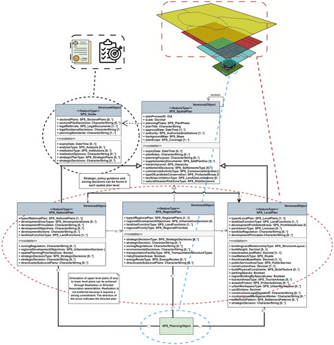
Table 8. Comparison of studies in the field of spatial planning data standardization.