
Figures & data
Figure 1. Lake of the Woods (from DeSellas et al. Citation2009).
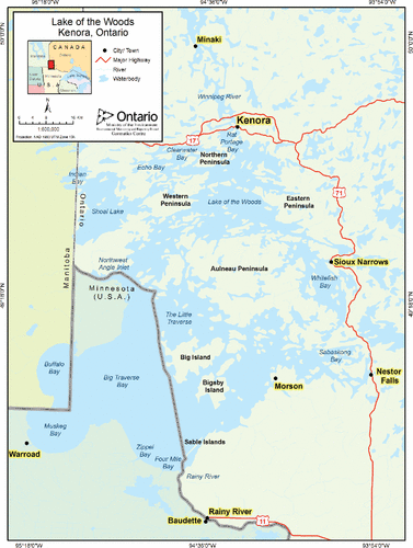
Figure 2. Generalized water flow paths in the southern and central basins of Lake of the Woods. Dotted black line is international border, circle is hydrologic outlet of southern basins in the Big Narrows vicinity.
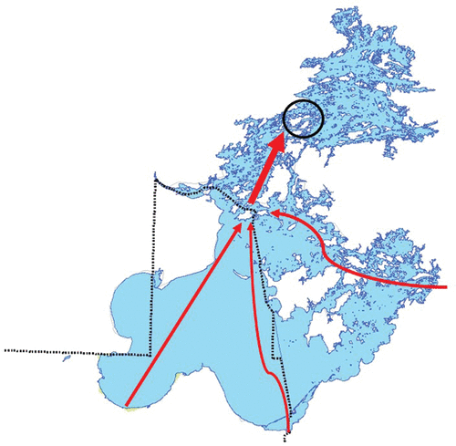
Table 1. Lake total phosphorus guidelines, standards, or objectives for Manitoba, Ontario, and Minnesota waters of Lake of the Woods.
