Figures & data
Figure 1. The location of the characteristics of the 25 major river sub-basinsin Thailand.
Source: Food and Agriculture Organization (2011) [3].
![Figure 1. The location of the characteristics of the 25 major river sub-basinsin Thailand.Source: Food and Agriculture Organization (2011) [3].](/cms/asset/4e50f7e6-9a9a-4bf6-bfcf-ec8c60514380/becj_a_1765529_f0001_c.jpg)
Figure 2. The graphics of forestry resource in boundary and utilizing lands in the national parks of governance through the Chi River Basin.
Source: Water Crisis Prevention Center (2012).
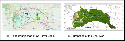
Figure 3. The head water of the Chi River Basin, and the Petchbun Mountains whereas the original of the Chi River.
Source: Majang (Citation2005)
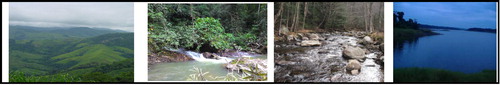
Figure 4. Occupation projects’ model and irrigation activity areas of the Chi River Basin.
Source: RakThammachat.com (Citation2017)
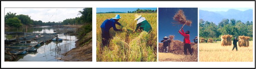
Figure 5. Graphic of population projection (a) and population’s occupations at the Chi River Basin (b).
Source: The World Bank Document (Citation2011) (a) and Office of Royal Development Projects Board (RDPB) (Citation2009)(b)
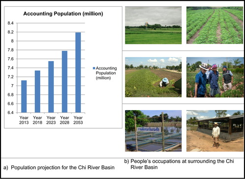
Figure 6. Local wisdom and traditional water management of rural communities with the Integration Participatory Action Research (IPAR) method are the group discussions and solving-problem concencious according to the traditional and regular roles in effectiveness and fairness of the Chi River Basin with researcm team together.
Source: Research team
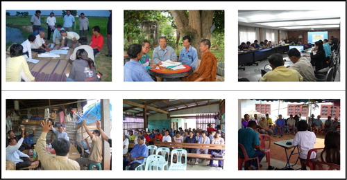
Figure 7. Environmental locations and situations in the different seasons.
Source: GuideUbon.com (2015)
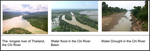
Figure 8. Main Chi River profiles’ activities of Northeastern Region, the 5-branch streams, and river’s resource management with the Dams, water storage weir, drainage weir.
Source: BasisChiInfo (2015)
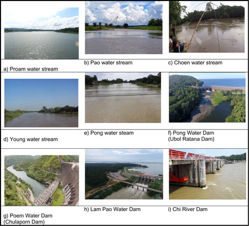
Table 1. Coverage of the Chi River Basin in the Provincial Areas.
Figure 9. Lifestyle, local wisdom and traditional roles at the local communities whereas they are surrounding at the Chi River Basin.
Source: Photos by research team
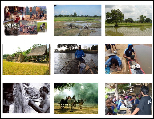
Table 2. Types of the utilizing lands in the National Parks through the Chi River Basin.
Table 3. Details of the principal tributaries of the Chi River.
Table 4. Summary of climate information.
Figure 10. Rice field processing product.
Source: Photos by research team
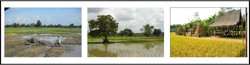
Figure 11. Lifestyle, local wisdom and traditional roles at the local communities whereas they are surrounding at the Chi River Basin.
Source: Photos by research team
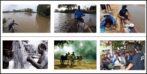
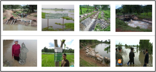
Figure 12. Lifestyle, local wisdom, and traditional water management of rural communities for effectiveness and fairness, problems of users, and construction and repair of damaged parts.
Source: Photos by Research Team (2013)
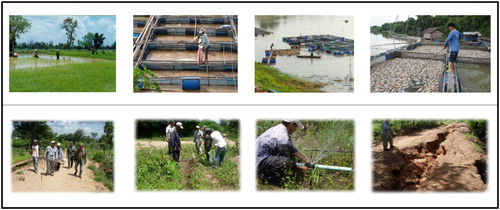
Figure 13. Principles and priorities of water rights and water allocation by local wisdom and communities.
Source: Photos by research team