Figures & data
Table 1. Size-resolved conversion factors ρ i (g cm− 3) used in Equationeq. 1.
Figure 1. Route map (MS: air quality monitoring stations; M: meteorological station; the arrow indicates the route start and finish point).
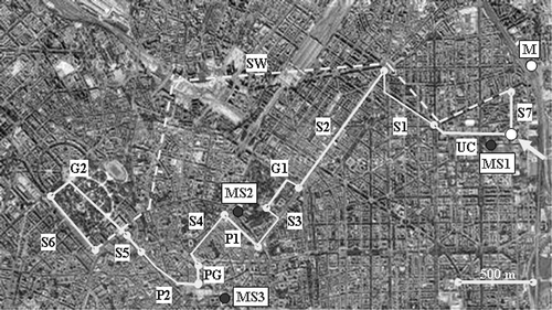
Table 2. Pedestrian route sector descriptions
Table 3. Air quality and meteorological conditions on measurement days
Figure 2. Time pattern of PM10 (solid line), PM2.5 (dashed line), and PM1 (thick line) concentration (μg m−3) measured during the afternoon route on May 19, 2010.
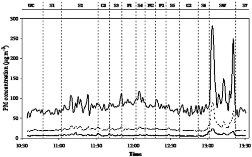
Figure 3. Sector-resolved box-plots for the distributions of 1-min PM10 concentrations (μg m−3) measured during the morning and afternoon routes.
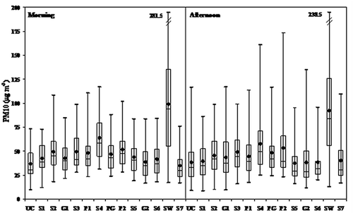
Figure 4. Sector-resolved box-plots for the distributions of 1-min PM2.5 concentrations (μg m−3) measured during the morning and afternoon routes.
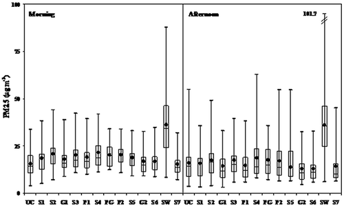
Figure 5. Sector-resolved box-plots for the distributions of 1-min PM1 concentrations (μg m−3) measured during the morning and afternoon routes.
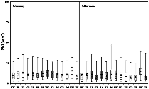
Figure 6. Sector averaged mass distribution (thin lines, white symbols: morning route; thick lines, black symbols: afternoon route) for sectors G2, S2, and SW.
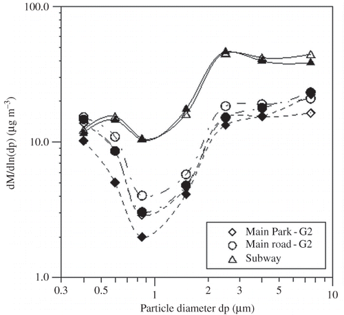
Figure 7. Size-resolved box-plots for the distributions of the route-averaged exposures (μg m−3) measured during the morning and afternoon routes. (Diamonds: the Sunday's afternoon route.)
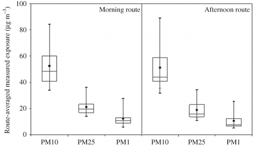
Figure 8. Representation of the sectors on the factorial plane in the morning (upper panel) and in the afternoon (lower panel). Variable considered: particle number size distribution. (Circled data points represent SW sector; grey symbols represent the rainy days.)
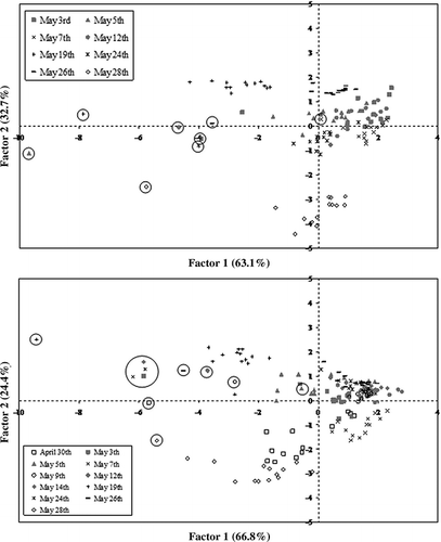
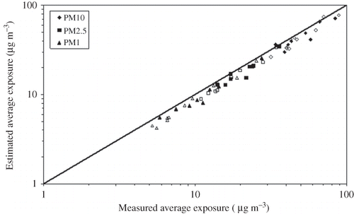
Figure 9. Comparison between the estimated and measured average exposures for the morning (black symbols) and afternoon (white symbols) routes.