Figures & data
Figure 1. Map of Sri Lanka, 1766–1796, by © Thijs Hermsen (Humanities lab, Faculty of Arts, Radboud University).
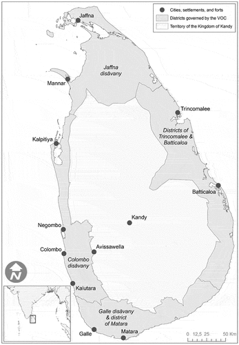
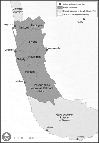
Figure 2. Map of Sri Lanka, 1766–1796, detail of southwestern Colombo and Galle provinces by © Thijs Hermsen (Humanities Lab, Faculty of Arts, Radboud University).