Figures & data
Table 1. Dimensions of adaptation options (Source: AMAP, Citation2017a, Citation2017b, p. 242).
Table 2. Overview of the interviewees.
Figure 1. The case study area. Arkhangelsk - Kegostrov line illustrates an example of an intercity shipping line. Other two illustrate examples of suburban shipping lines.
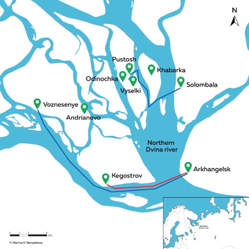
Figure 2. Private boats (2a) and a passenger vessel (2b). Both photos are taken near the village of Voznesenie. Photographer: Julia Olsen.
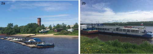
Table 3. The number of river transport routes (Arkhangelsk River Port, Citation2019).
Table 4. Description of transportation and mobility options during three navigation seasons.
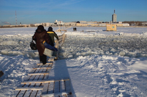
Figure 3. A temporary bridge is used by island residents to cross a shipping corridor over the North Dvina River on their way to Arkhangelsk. Photographer: Rune Rafaelsen/Barentssekretariatet.