Figures & data
Figure 1. GIS map of the No. 6 Naphtha Cracking Complex, its major SOx emission sources and affected areas, and the downwind direction with a wind rose diagram from the Taishi air quality monitoring station from 1995 to 2009.
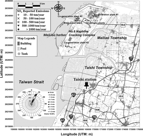
Table 1. Major SO2 emissions from manufacturing plants of the No. 6 Naphtha Cracking Complex in Taiwan in 2009
Table 2. Summary statistics for hourly SO2 concentrations (ppb) at the Taishi air quality monitoring station from 1995 to 2009
Figure 2. The 99th percentile 3-yr average SO2 concentration and 3-yr moving average SOx emissions at the Taishi air quality monitoring station from 1995 to 2009.
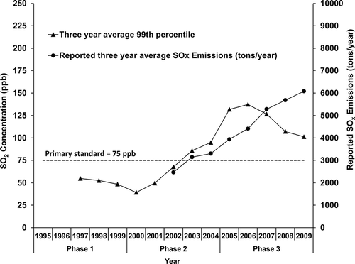
Figure 3. SO2 pollution roses of averages (a, b, c) and percentiles (d, e, f) at the Taishi air quality monitoring station from 1995 to 2009.
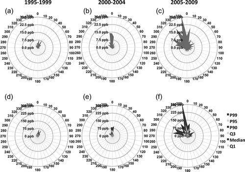
Figure 4. Wind-speed-specific SO2 concentrations (mean + SD) during emission-affecting periods (downwind) from the petrochemical complex and traffic emission-affecting periods (land-wind) and nonaffecting periods (sea-wind) at the Taishi air quality monitoring station from 1995 to 2009. (a) 1995–1999, (b) 2000–2004, and (c) 2005–2009.
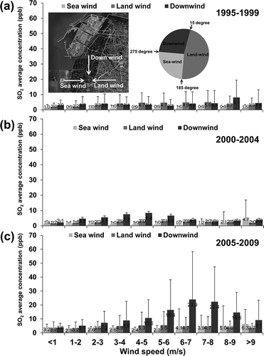
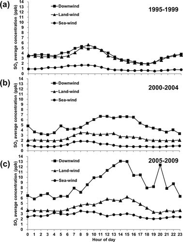
Figure 5. Diurnal SO2 concentrations during emission-affecting periods (downwind) from the petrochemical complex and traffic-affecting periods (land-wind) and nonaffecting periods (sea-wind) at the Taishi air quality monitoring station from 1995 to 2009. (a) 1995–1999, (b) 2000–2004, and (c) 2005–2009.