Figures & data
Figure 1. Hierarchy of the SW management strategies. Modified from AEPA (1996).
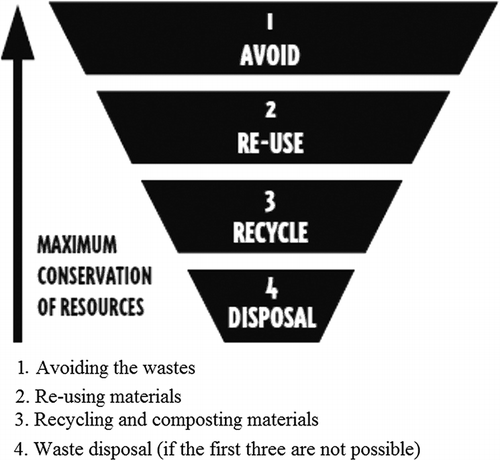
Figure 2. Location of Bauru municipality, São Paulo State.
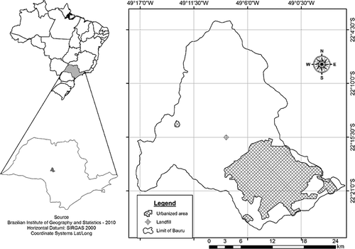
Figure 3. Monthly values of temperature and rainfall for Bauru municipality (Center of Meteorological and Climatologic Researches Applied in Agriculture, 2010).
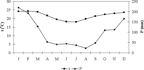
Table 1. Minor criteria considered in major restrictive for identification of suitable areas for installation of the landfill in Bauru
Figure 4. Maps depicting all restrictive features considered for study area: (a) river network, (b) wells, (c) slope map, (d) areas with ecological restrictions, and (e) buffer of urban settlements.
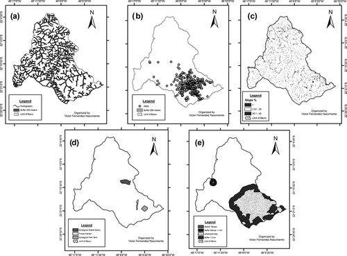
Table 1. Minor criteria considered in major limiting for classification of areas for installation of the landfill in Bauru as being suitable or moderately suitable
Figure 5. Limitation features: buffer map of airports (a), environmental protection areas (b), wind directions (c), and highway and streets network (d).
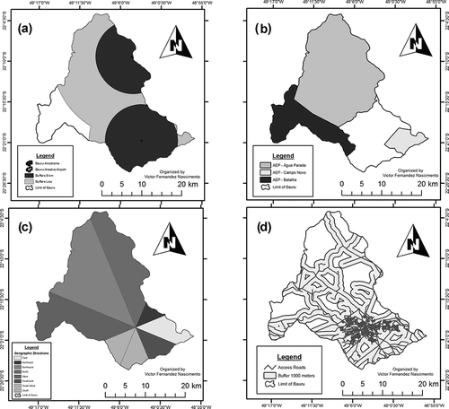
Figure 6. Scenario generated considering all restrictive and limiting features, but considering a buffer of 9 km for airports.
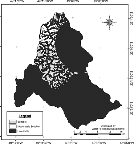
Table 3. Percentage of occurrence of each class for the scenario generated considering all restrictive and limiting features, but considering a buffer of 9 km for airports
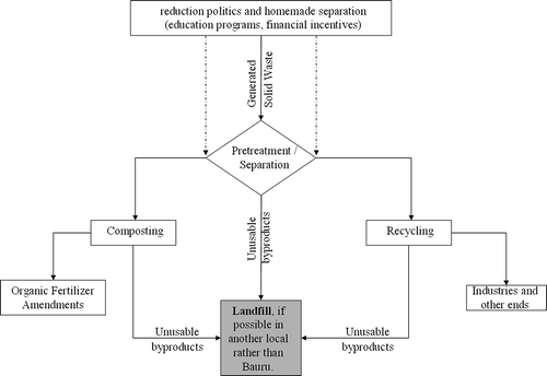
Figure 7. Flowchart of the steps of the general process of reduction in order to minimize the amount of SW destined to landfill. Dashed lines correspond to materials that could be sent directly to plants for composting or recycling, due to high quality (desirably).