Figures & data
Figure 1. Ozone monitoring sites in the United States.
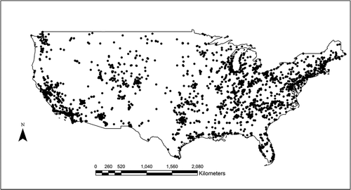
Table 1. Cross-validated total R2, spatial R2, temporal R2, and corresponding MSE between monitored and predicted ozone in each year for the study area.
Table 2. Cross-validated total R2, spatial R2, temporal R2, and corresponding MSE between monitored and predicted ozone in each year divided by season.
Table 3. Cross-validated total R2, spatial R2, temporal R2, and corresponding MSE between monitored and predicted ozone in each year divided by U.S. Census Divisions.
Figure 2. Model performance in the continental United States. This figure visualizes the total R2 between monitored and predicted ozone. We interpolated R2 to areas without monitors using Kriging interpolation. Spring was defined as March to May; summer was defined as June to August; autumn was defined as September to November; winter was from December to February of the next year.
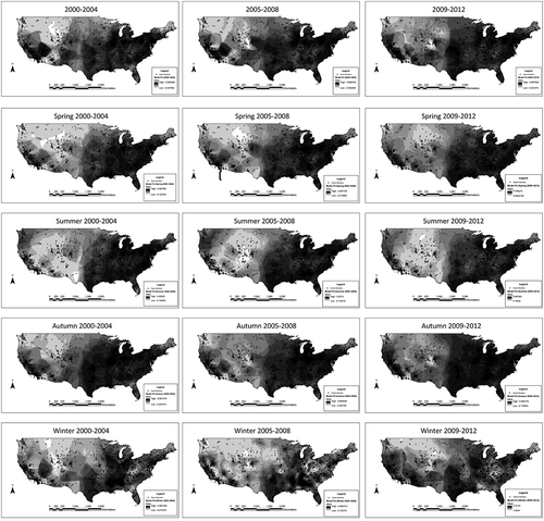
Figure 3. Spatial distribution of predicted ozone. The trained neural network predicted ozone at 1 km × 1 km grid cells. Those figures visualize annual averages and seasonal averages of predicted ozone for 2000~2004, 2005~2008, and 2009~2012. (Seasons were defined as in .)
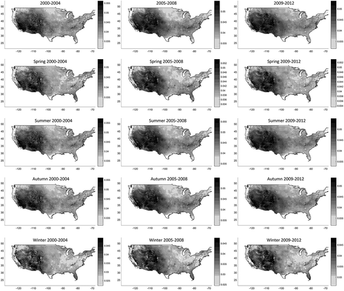
Figure 4. Regional trend in ozone levels at national and regional levels. Concentration is defined by annual fourth maximums of daily 8hr-max.
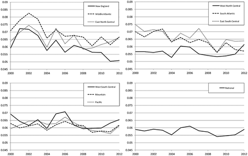
Figure 5. Seasonal averages by urban and rural area. Seasonal averages were computed by averaging predicted ozone at all 1 km × 1 km grid cells in urban or rural areas. Urban areas are defined by developed areas above 50% based on National Land Cover Database (NLCD) 2001, 2006, and 2011 (Fry et al., Citation2011; Xian et al., Citation2011).
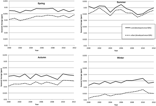
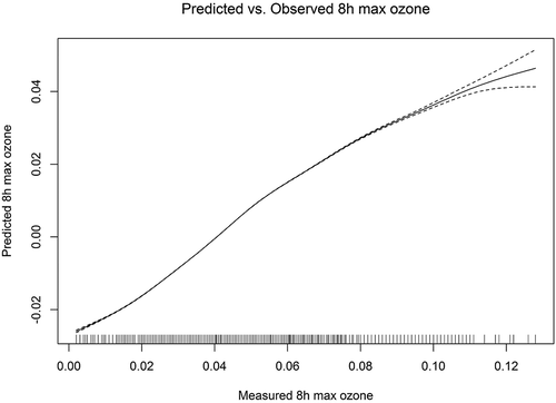
Figure 6. Relationship between measured and predicted ozone. We fitted a regression of predicted ozone on monitored ozone with penalized spline. To assess the linearity between predicted and monitored ozone, we did not specify the degrees of freedom. This figure is for year 2009.