Figures & data
Figure 1. Location of South Batinah and Muscat Governorate with districts. (Red lines show the boundary of wilaya/districts in the governorates of South Batinah and Muscat).
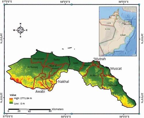
Table 1. Description and grading values of final criteria.
Table 2. Data requirement for each criterion.
Table 3. Relative weights of criteria.
Figure 2. Suitability ranking of individual criteria, i.e., red (0) is restricted area, 1–4 represents low suitability, 5–7 represents moderate suitability, and 8–9 is highly suitable area.
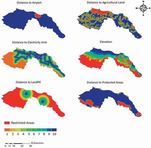
Figure 3. Suitability ranking of individual criteria, i.e., red (0) is restricted area, 1–4 represents low suitability, 5–7 represents moderate suitability, and 8–9 is highly suitable area.
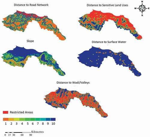
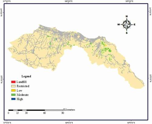
Figure 4. Integrated suitability maps with candidate site.
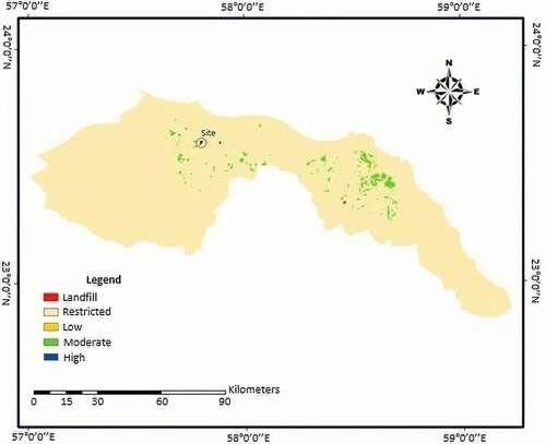
Figure 5. Integrated suitability maps with road network.