
Figures & data
Table I. Overview of the four Andalusian basins and results obtained for brown trout in them.
Figure 1. Location of Andalusia (in gray shading). The Iberian Peninsula basins are delimited in the figure. Four of them form part of Andalusia: (1) Guadiana, (2) Segura, (3) Guadalquivir and (4) South.
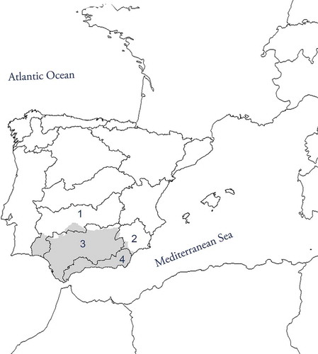
Figure 2. (A) Altimetry of the study region (meters above sea level, m a.s.l.); (B) distribution of the brown trout in Andalusia: thick lines delimit Andalusia, shaded lines demarcate the basins (see ) and the boxes show the areas where brown trout populations are present; (C, D) detailed distributions. The light gray surfaces are natural parks and the dark gray surfaces are national parks. These natural reserves are named, and the inhabiting rivers are numbered, according to the codes in the supplemental online data.
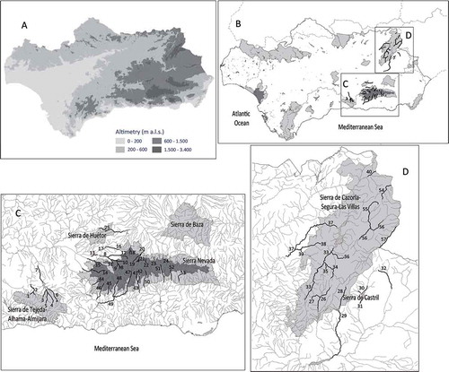
Figure 3. Altitudinal ranges (meters above sea level, m a.s.l.) inhabited by each population (reaches codes in brackets are as listed in the supplemental data), causes of their upper and lower limits (natural indicated with empty symbols, and anthropogenic with solid symbols) and natural reserves containing all, or part, of the reaches inhabited by the population. Causes of the limits: ![]()
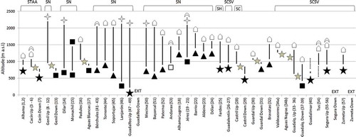
Table II. Kilometers of river inhabited by brown trout in the Andalusian basins, and inhabited partial percentages in each basin. Distribution inside and outside of natural reserves is shown. Gray cells indicate where the trout is managed as a fishing resource (Andalusian law, Orden 6 de mayo de 2014).
Table III. Causes delimiting the brown trout populations in Andalusia in their upper and lower limits. The types of factors and particular causes are shown.
Table IV. Reaches inhabited by rainbow trout coinciding with reaches currently or historically inhabited by the brown trout in Andalusia. Only reaches close to the current distribution of the native salmonid are considered. The rivers designated as “Oncorhynchus mykiss” were inhabited by brown trout in the past (Sáez Gomez Citation2010). The current administrative figure (Andalusian law, Orden 6 de mayo 2014), its length, reaches to which they belong (codes in the supplemental online data) and salmonids detected in each case are indicated. NLFA: non-limited access fishing areas; SFA: stocked fishing areas (some in reaches inhabited by brown trout). Asterisks (*) indicate reaches where rainbow trout reproduction has been confirmed. Shading cells in the “Salmo trutta & Oncorhynchus mykiss” column indicate that both species are present in these reaches; shading cells in the “Oncorhynchus mykiss” column indicate that this species is the only one present in those reaches.