Figures & data
Figure 1. Maungatautari the mountain and ecological island, near Cambridge, New Zealand, shown south of the Lake Karapiro reservoir portion of the Waikato River. Te Ara, the Encyclopedia of New Zealand (Citation2005–2013). Used with permission.
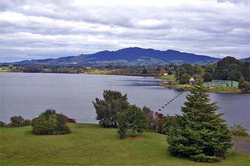
Figure 2. An aerial view of a portion of pest-proof fencing and indigenous forest at Maungatautari. Te Ara, the Encyclopedia of New Zealand (Citation2005–2013). Used with permission.
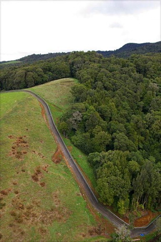
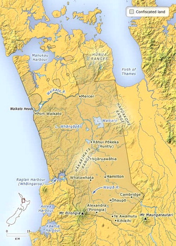
Figure 3. Maori tribal land confiscated between Auckland and Kihikihi in the more northern areas of the Waikato region, c.1869. Te Ara, the Encyclopedia of New Zealand (Citation2005–2013). Used with permission.