Figures & data
Figure 1. Location of the study area showing extent of the Cambrian Limestone aquifer (CLA) and underlying Beetaloo basin, the boundary between Top End and Arid zones as defined in the NT water allocation framework, and relevant water allocation plan areas. SREBA = Strategic Regional environmental and Baseline Assessment area, as defined in Northern Territory Government (Citation2020).
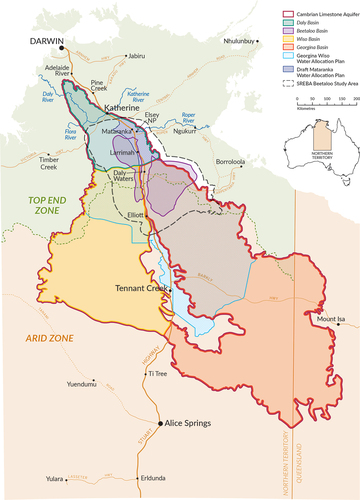
Table 1. Estimates of groundwater recharge rate to the CLA.
Table 2. Current status of knowledge regarding groundwater resources of the CLA.
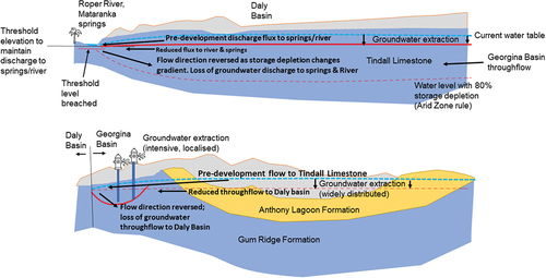
Figure 2. Conceptual representation of the risk/impact of increasing rates of extraction from Cambrian Limestone aquifer sub-regions (modified from Currell and Ndehedehe Citation2022). Note that water level surfaces are approximate representations, for visualisation purposes only.