
Figures & data
Figure 1. The Murray-Darling Basin with the Australian Alps region highlighted. Major watercourses as defined by the Geoscience Australia are shown. The Murray and Murrumbidgee Rivers are highlighted, as these are the two major snow affected rivers in the basin.
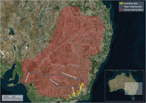
Figure 2. Classification scheme of hydrological models, based on model structure and spatial representation of the area (i.e. catchment) to be modelled, and snowmelt models that are included in hydrological models.
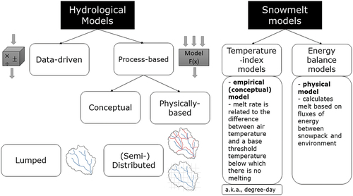
Table 1. Past hydrological modelling of snow-affected catchments on mainland Australia (excluding Tasmania).
Supplemental material