
Figures & data
Figure 1. The framework estimating the effects of specific zoning on land use
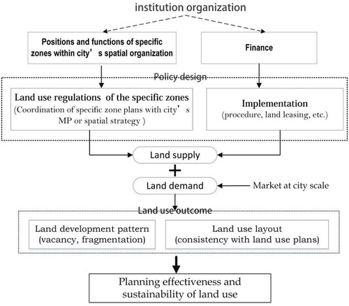
Figure 2. Central proper area of Yinchuan City
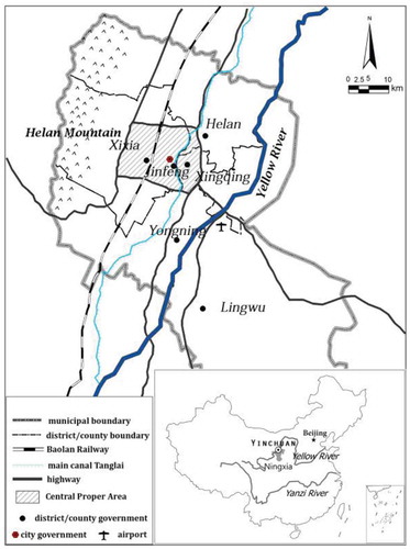
Figure 3. Special zones, land use context and master plans
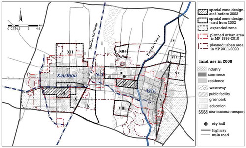
Table 1. Designation and development of special zones
Table 2. Land development in the case zones (2010–2016)
Figure 4. The Jinfeng Industry Zone: a) land development process 2004–2016; b) land use layout (2016)
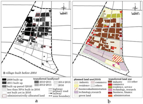
Figure 5. (a) Vacant land enclosed by a factory in Jingfeng Industrial Zone; (b) Wide “green belt” that surrounds the new campus in Vocational Training Zone. Photographed by author in Aug. 2017
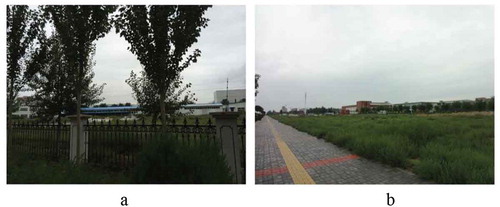
Figure 6. The vocational training base: (a) land development process 2008–2016; (b) land use layout (2016)
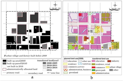
Figure 7. The trading & distribution center: (a) land development process 2010–2016; (b) land use layout (2016)
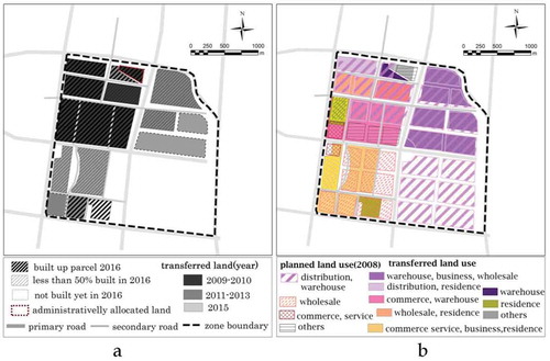
Figure 8. The new CBD: (a) the land development process 2010–2016; (b) the land-use layout (2016)
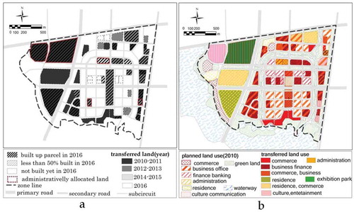
Figure 9. ETDZ-3: (a) Land use plan 2003 and land-use layout 2008; (b) Land use plan 2010 and land-use layout 2016; (c) Land development process (2003–2016)
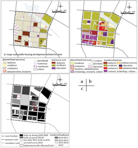
Table 3. Implementation, planning intentions and resultant land use in the 3 zone types.