Figures & data
Figure 1. Shecun Community (a) Location map of Shecun Community, Jiangning District, Nanjing city, Jiangsu Province; (b) The Shecun Community layout and surrounding environment.
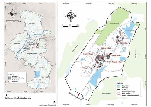
Figure 2. Layout of the Shecun Community and space segragation.
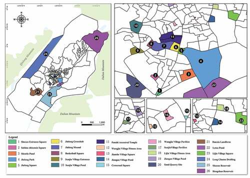
Figure 3. Analysis framework.
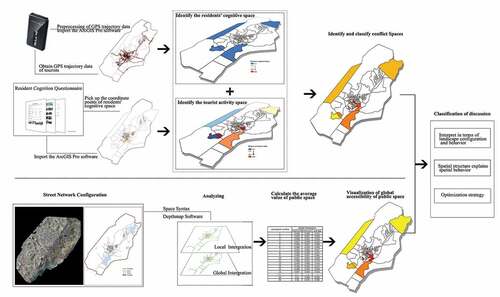
Figure 4. Spatial Distribution of Tourist Visits. (a) High visitor rate of community space; (b) Low visitor rate of community space. (c) the tourist visiting degreen of Shecun Community space.
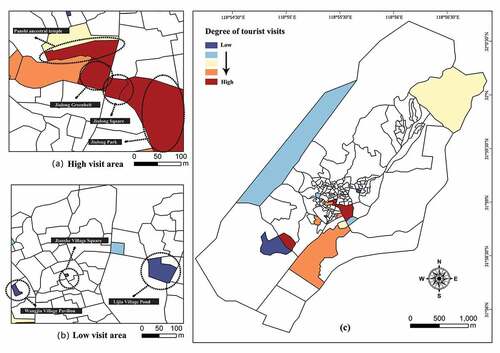
Figure 5. Spatial Distribution of Resident Cognition. (a)The community space with a high degree of resident awareness. (b)The community space with a low degree of resident awareness. (c)The resident cognition degree of Shecun Community space.
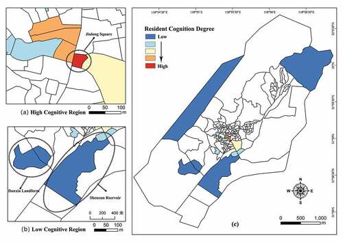
Figure 6. Classification of Spatial Behavior Conflict.
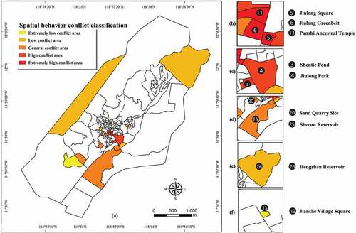
Figure 7. Global Integration and Local Integration of the Shecun Community. (a)The result of the Global Integration; (b)&(c) The result of the Local Integration; (d) Correlation analysis between spatial behavior conflict index and global integration degree.
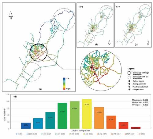
Figure 8. Box-whisker Plot of Global Integration by Community Space Units.
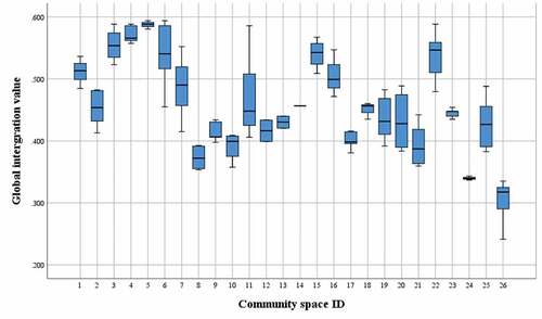
Figure 9. Global Integration of the Space Units.
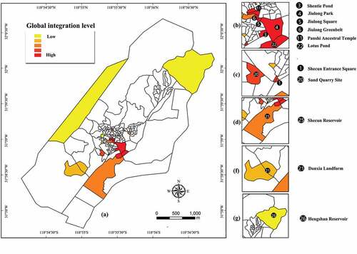
Figure 10. Observed Characteristics of Different Types of Spatial Behavior Conflict Areas.
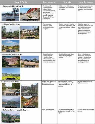
Table 1. Correlation analysis of spatial behavior conflict and spatial integration.
Figure 11. Correlation between Global Integration and Spatial Behavior Conflict in Shecun Village. (a)Global integration of the community space; (b)Spatial behavior conflict of the community space; (c)The correlation analysis values between global integration and spatial behavior conflict.
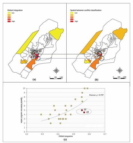
Figure 12. Shecun Village Community Space Priority Level and Strategy.
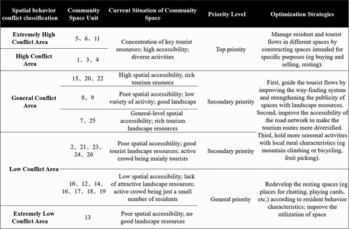
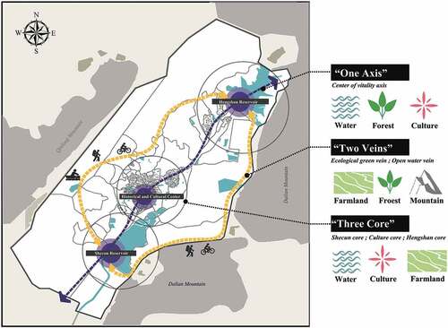
Figure 13. A Concept Map for Shecun’s Landscape Planning.