Figures & data
Figure 1. Location of gully regions.
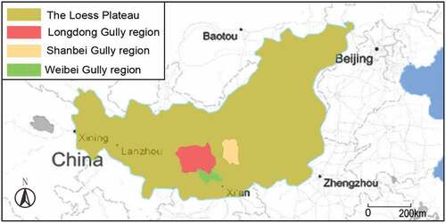
Table 1. Space distribution in gully regions of the Loess Plateau.
Figure 2. The same outlook of villages in Qianyang County. (a) Xiaozhai village. (b) Longquansi village. (c) Sipo village.
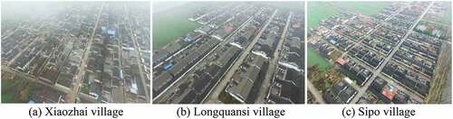
Table 2. Comparison of commonly used ecological carrying capacity research methods.
Figure 3. Present situation of Tao Qu Yuan Village. (a) North bird’s view of village. (b) South bird’s view of village.
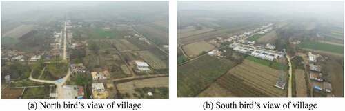
Figure 4. Present situations on revolutionary tourist spot in Tao Qu Yuan village. (a) Original place of directorate in Ye Tai Shan Battle. (b) Tao Qu Yuan Revolutionary museum. (c) Greening landscape in tourist resort. (d) Architecture landscape in tourist resort.
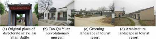
Figure 5. Present situation of infrastructure in Tao Qu Yuan village. (a) Main village road. (b) Drainage ditch. (c) Road landscape in village. (d) Center village landscape.
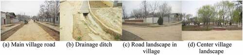
Figure 6. Cultivable land carrying capacity of the villages in current time and 2025.
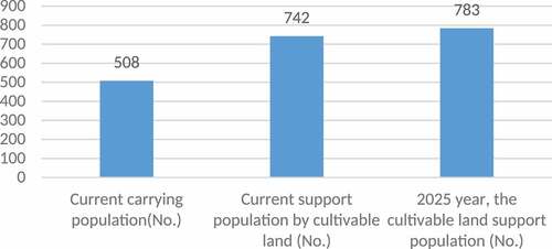
Table 3. Current cultivable land areas and the supporting population in research areas.
Figure 7. Present construction situation and suitable construction land in Tao Qu Yuan village.
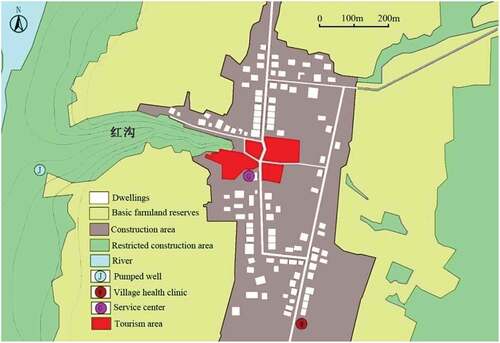
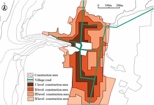
Figure 8. Division of suitable construction land.
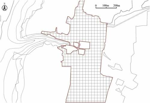
Figure 9. Distribution map of water resource carrying capacity.
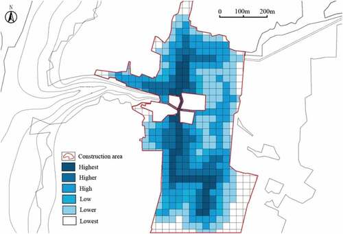
Table 4. Statistics on the investigation of infrastructure importance and their influencing index.
Figure 10. Distribution map of infrastructure carrying capacity.
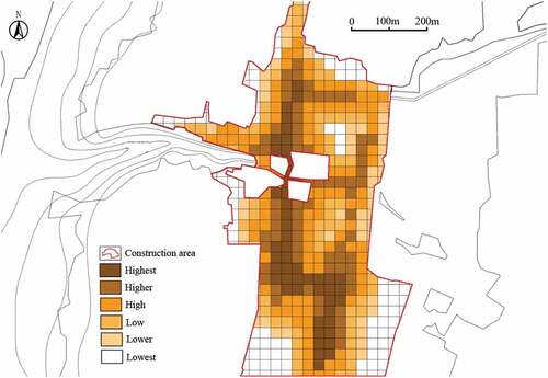
Figure 11. Overlaying distribution map of water resource and infrastructure carrying capacity.
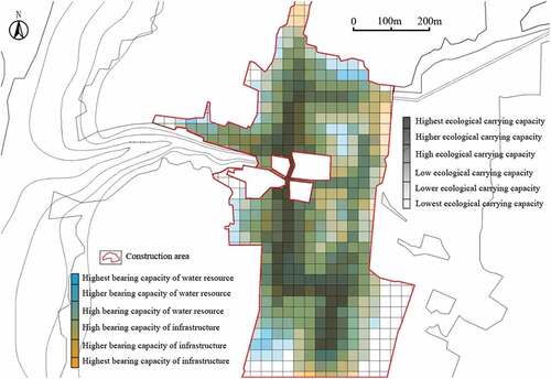
Figure 12. Division of priority construction area in Tao Qu Yuan village.