
Figures & data
Figure 1. Overview of the study area.
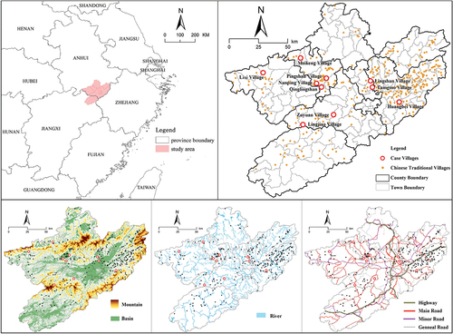
Table 1. Basic situation of the village cases.
Figure 2. The structure and element composition of the traditional village revitalization system.
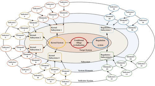
Figure 3. Comprehensive dynamic analysis of village development.
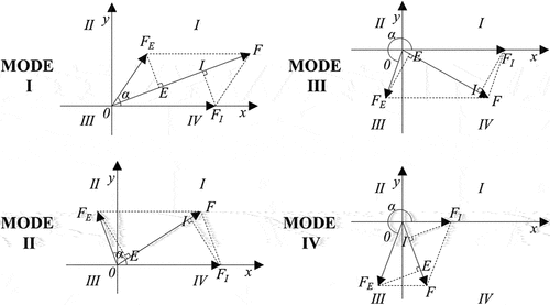
Table 2. Dynamic analysis of the revitalization system.
Table 3. Dynamic index system of the traditional village revitalization system.
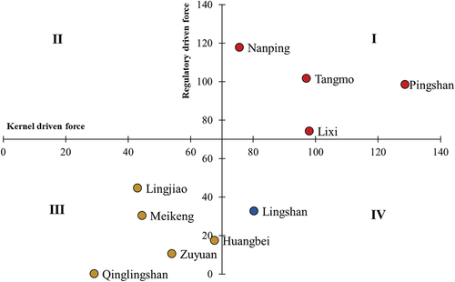
Table 4. Calculation results of driving forces of villages.
Table 5. The division of traditional village revitalization modes based on system dynamics.
Figure 4. Classification of village types based on primary driving forces.
Data availability statement
The research data mostly fall into three categories: (1) vector geographic information data from China’s National Catalogue Service for Geographic Information (https://www.webmap.cn/), including administrative divisions, road data, and water systems. (2) raster data for the research region obtained from the Geospatial Data Cloud Platform (http://www.gscloud.cn/), including DEM and remote sensing image data. (3) Statistical data, such as information on villagers’ income, village population, and ancient village structures, culled from the archival records of each village designated as a national traditional village and maintained by county-level housing and construction departments, some of which have been digitized and archived and are available through the Traditional Chinese Village Digital Museum (http://www.dmctv.cn/).