Figures & data
Figure 1. (a) location of Suzhou; (b) Tiger Hill in Suzhou; (c) overall bird’s-eye view of Tiger Hill (source: Management Office of Tiger Hill); (d) the façade of Tiger Hill (source: Suzhou Garden and Greening Administration Bureau).
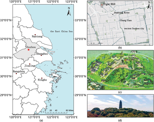
Figure 2. Methodological framework.
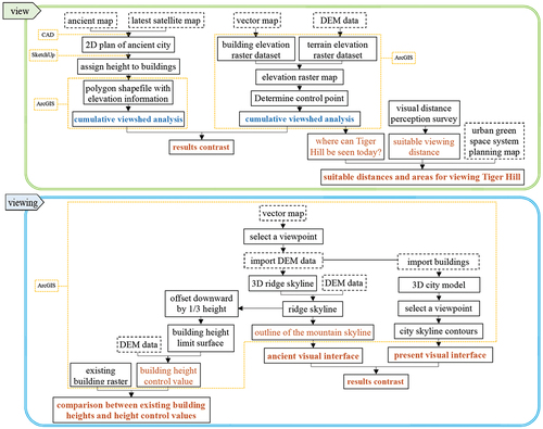
Figure 3. (a) Complete map of Suzhou Police Districts created in 1908; (b) two-dimensional reconstruction map of Suzhou in 1908.
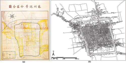
Figure 4. (a) the visual interface of Tiger Hill viewing the southern and western mountains based on real viewpoints; (b) the panoramic city visual interface from the top of Tiger Hill.
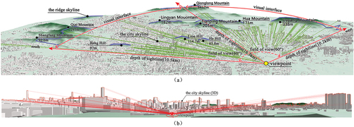
Figure 5. Tiger Hill at different visual distances.
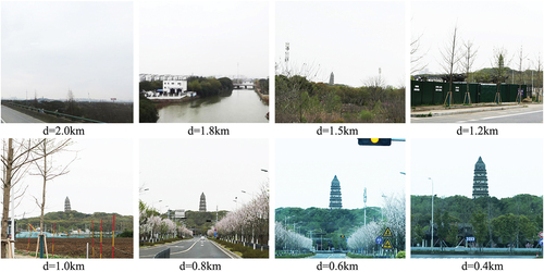
Figure 6. The cumulative viewshed analysis result of Tiger Hill in ancient (a) and current (b) Suzhou.
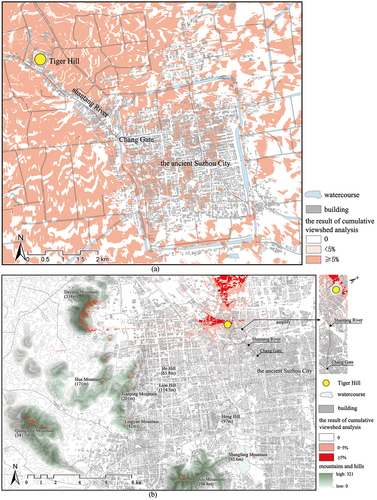
Figure 7. (a–d) questionnaire results. The mean ± SD, n = 54, * p < 0.05, *** p < 0.001 using the Wilcoxon signed-rank test; (e) the visual perception of Tiger Hill under different visual distances.
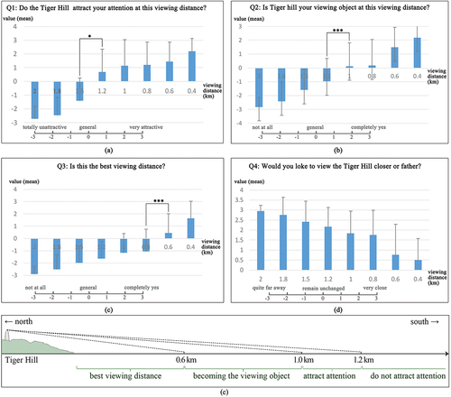
Figure 8. The superimposed result of the cumulative viewshed analysis result and the urban green space system planning map of Gusu District in Suzhou.
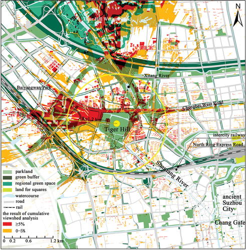
Figure 9. The panoramic visual interface from the viewpoint on the top of Tiger Hill to the south and west.
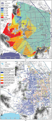
Figure 10. (a) result of building height control analysis; (b) result of the comparison between the height of existing buildings and the building height control values.