Figures & data
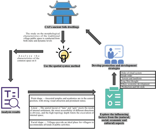
Figure 1. Cai’s Ancient Residence Complex.
Table 1. Map of the five different phases.
Table 2. Description of spatial syntactic feature parameters.
Figure 2. Research framework.
Figure 3. Public space (a).
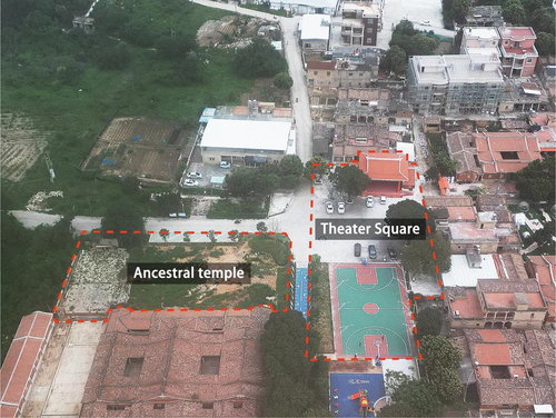
Figure 4. Public space (b).
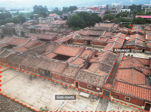
Figure 5. Public space (c).
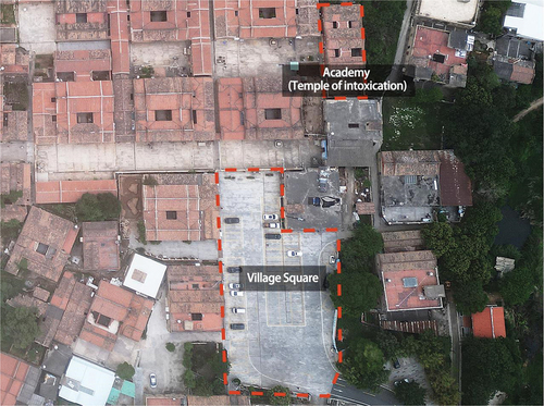
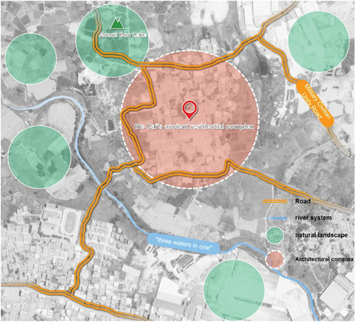
Figure 6. Google Earth high-definition remote sensing image map.
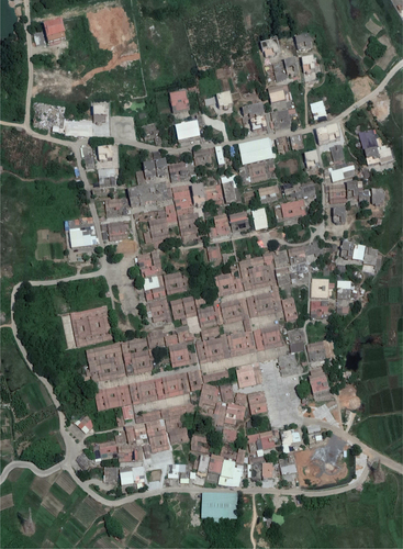
Figure 7. Conservation Plan for Zhangli Village.
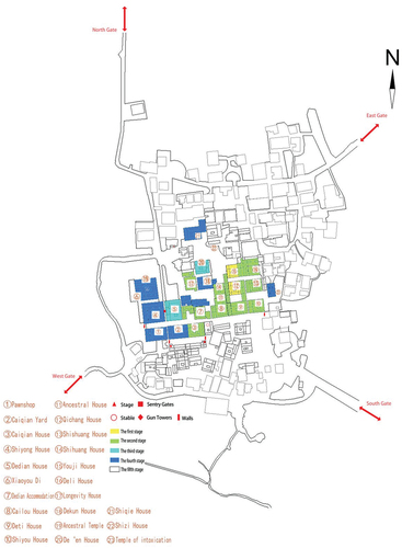
Figure 8. Axial view of Zhangli village.
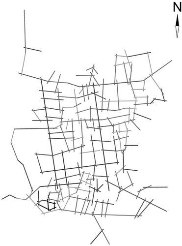
Figure 9. Axial Integration Degree of Cai’s Ancient Residence.
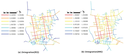
Figure 10. Comprehensibility analysis of the axes of Cai’s Ancient Residence.
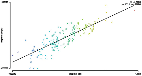
Figure 11. Analysis of the depth values of the four entrance/exit axes.
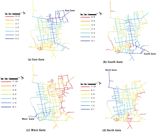
Figure 12. Analysis of the depth value of the point-like spatial axis of the ancestral hall and the academy.
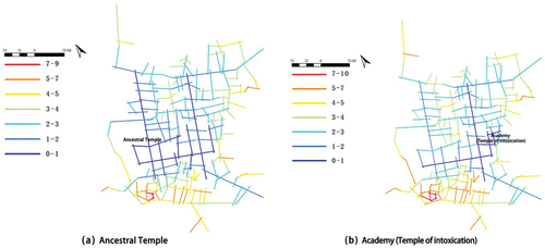
Figure 13. Analysis of the depth values of the axes of the linear space “Alleyways and gate courts”.
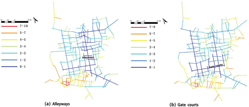
Figure 14. Analysis of the depth value of the spatial axis of the surface of “Theater Square” and “Village Square”.
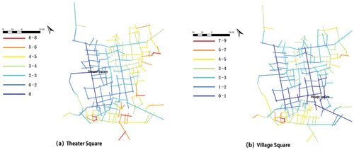
Figure 15. Visual integration analysis map of Cai’s Ancient Residence.

Figure 16. Depth value analysis of the four entrances and exits of the Cai’s Ancient Residence.
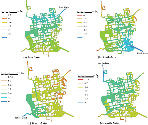
Figure 17. Actual view of the ancestral temple and the academy.
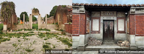
Figure 18. The Ancestral Hall and the academy and Schematic Distribution of Areas.
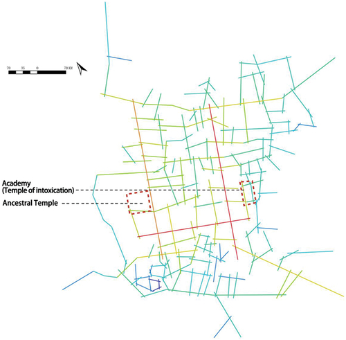
Figure 19. Actual view of the alleyways and gate courts.
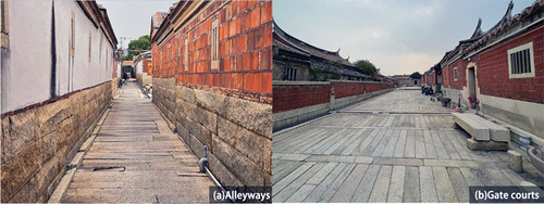
Figure 20. The alleyways and Gate courts and Schematic Distribution of Areas.
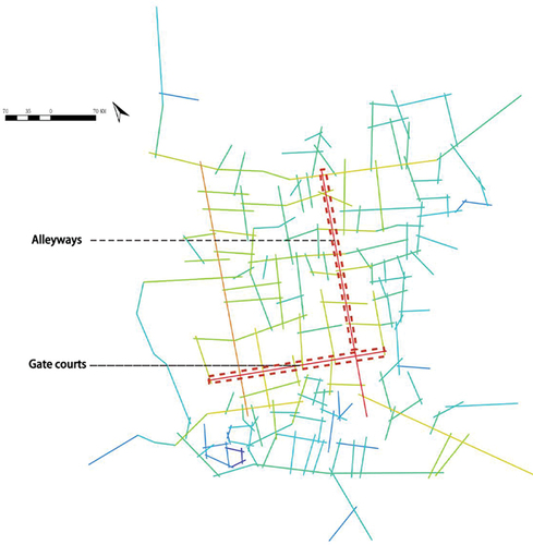
Figure 21. Actual view of Theater Square and Village Square.
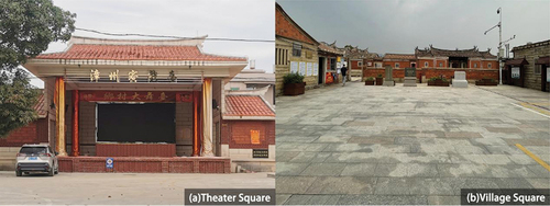
Figure 22. Theater Square, Village Square and Schematic Distribution of Areas.
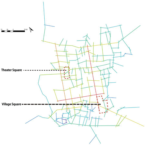
Figure 23. Schematic diagram of the surrounding environment of the Cai’s Ancient Residence.