Figures & data
Figure 1. International and regional studies on neighbourhood planning (Source: developed by authors).
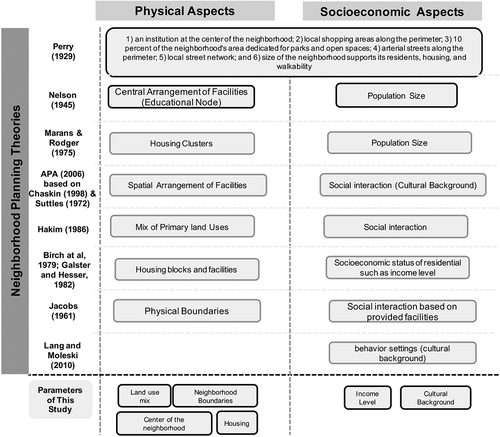
Figure 2. Evolution of neighbourhoods of Doha based on the attached housing agglomerations (Source: Skyscraper City Citation2007; Al Malki Citation2017; Lockerbie Citation2018).
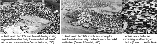
Figure 3. The location of the study area: Fereej Abdulaziz neighbourhood in Doha as highlighted (Source: Ministry of Municipality and Environment Citation2015, adapted by the authors).
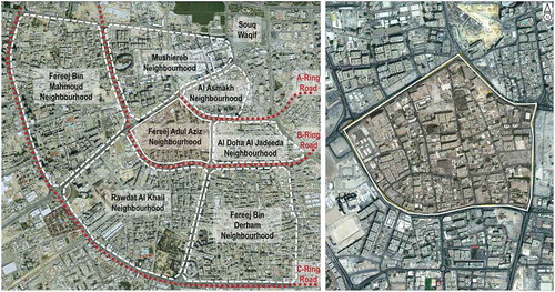
Figure 4. Urban evolution of Fereej Abdulaziz neighbourhood in Doha (Source: Ministry of Municipality and Environment Citation2015), Archive Department of Doha Satellite Imageries in 1995, 2003, and 2010.
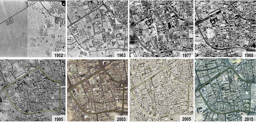
Figure 5. Land use planning map of Fereej Abdulaziz neighbourhood (Source: Ministry of Municipality and Environment Citation2015).
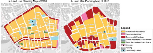
Figure 6. Existing land uses where land use changes are outlined (Source: Ministry of Municipality and Environment Citation2015, adapted by the authors based on the observation survey).
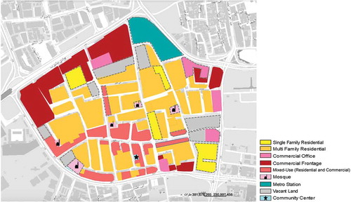
Figure 7. Significant differences in the land use mix in Fereej Abdulaziz (Source: the authors based on the observation survey).
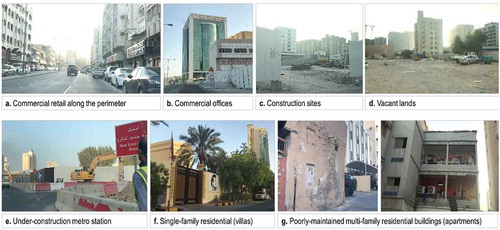
Figure 8. Residents’ preferences in terms of land use mix in Fereej Abdulaziz (Source: the authors based on the questionnaire survey).
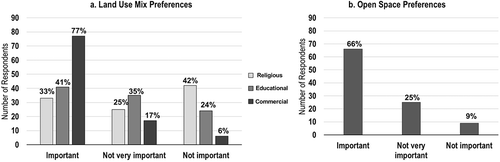
Figure 9. Street network in Fereej Abdul Aziz neighbourhood (Source: the authors).
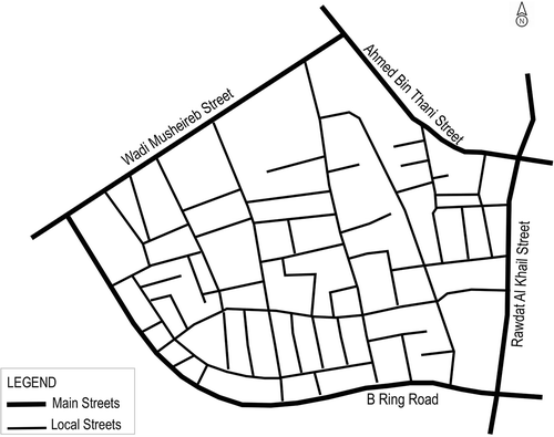
Figure 10. Vehicle-dominated streets where safe mobility considerations for pedestrians are lost (Source: the authors based on the observation survey).
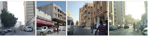
Figure 11. Accessibility preferences in Fereej Abdul Aziz neighbourhood (Source: the authors based on the questionnaire survey).
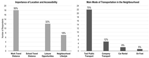
Figure 12. General street life in Fereej Abdul Aziz neighbourhood (Source: the authors based on the observation survey).
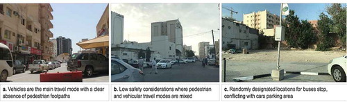
Figure 13. Housing preferences in Fereej Abdulaziz neighbourhood (Source: the authors based on the questionnaire survey).
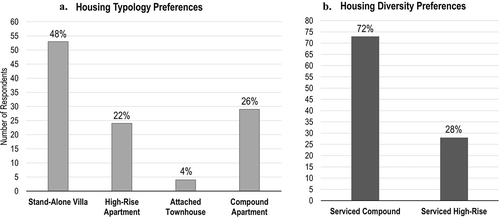
Figure 14. Income level of residents in Fereej Abdulaziz neighbourhood (Source: the authors based on the questionnaire survey).
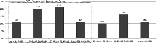
Figure 15. Income level indication based on the general housing quality in Fereej Abdulaziz neighbourhood (Source: the authors based on the observation survey).
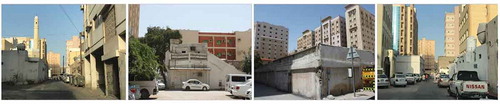
Figure 16. Annotated map of the observation survey route in Fereej Abdulaziz neighbourhood (Source: Ministry of Municipality and Environment Citation2015, adapted by the authors).
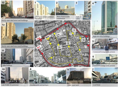
Table 1. Proposed planning for Fereej Abdulaziz neighbourhood- Existing and Future development (Source: developed by the authors).
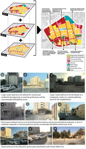
Figure 17. The developed prototype for Fereej Abdulaziz neighbourhood (Source: the authors).