Figures & data
Figure 1 Overview of East Jerusalem, the exclaves between Wall and Municipal Boundary and the routes of the Jerusalem-Ramallah Bus Company. Map produced by the author on the basis of Google Earth.
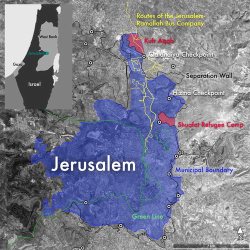
Figure 2 Qalandiya checkpoint seen from the North, 2015. Photo by the author.
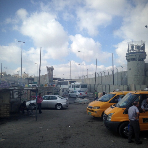
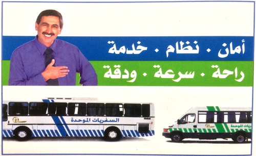
Figure 3 Section from an East Jerusalem bus map produced by the Israeli Ministry of Transport, 2013. The Arabic motto reads: ‘Safety—System—Service—Comfort—Speed—and Precision.’ Photo by the author.