
Figures & data
Figure 1. Climate-related multi-hazard risk map of Bangladesh.
Source: Sammonds et al. (Citation2021, 71).
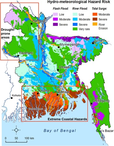
Figure 2. Key areasand questions to be tackled for a more intergrated HM-DR policy approach.
Source: Authors’ elaboration.
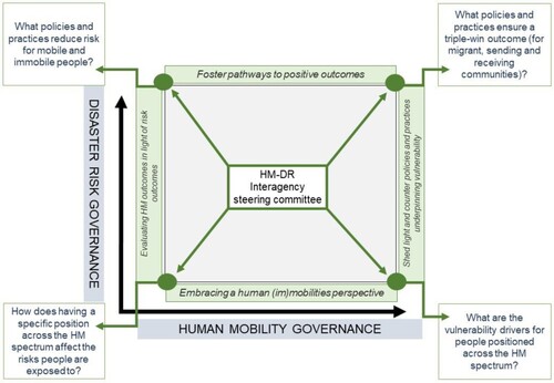
Figure 1. Climate-related multi-hazard risk map of Bangladesh.
Source: Sammonds et al. (Citation2021, 71).
Figure 2. Key areasand questions to be tackled for a more intergrated HM-DR policy approach.
Source: Authors’ elaboration.