Figures & data
Figure 1. GDA94 was adjusted in an hierarchical fashion, with lower-level networks being adjusted while holding the higher-level networks fixed. This led to distortions in parts of the network. GDA2020, however, was implemented via a single rigorous continental-scale adjustment – a first for an Australian datum. This allows the rigorous realisation of the frame down to the state and territory networks.
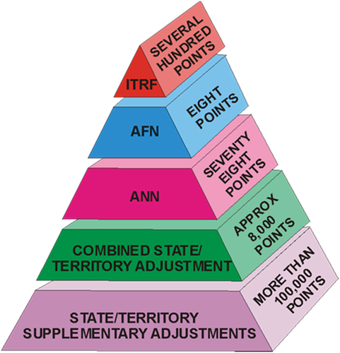
Figure 2. The GDA2020 update process. Each jurisdiction performs a jurisdictional adjustment that uses the latest APREF solution to constrain their combined NGCA and JDA networks. These jurisdictional adjustments are then combined into a single national adjustment to produce the GDA2020 coordinate set.
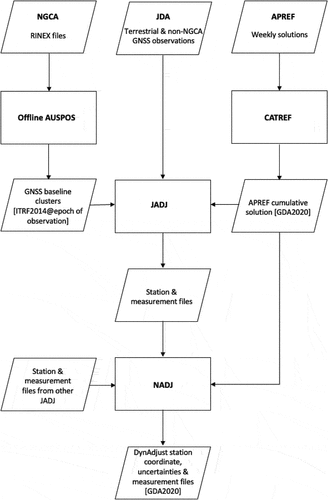
Figure 3. The area shown in dark blue is the extent of GDA2020 (ICSM Citation2021). The colours of the lines represent different types of jurisdictional boundaries. For more information, please refer to http://www.ga.gov.au/metadata- gateway/metadata/record/gcat_70362 today. The solution is transformed to [email protected] using the Australian Plate-Motion Model (ICSM Citation2021).
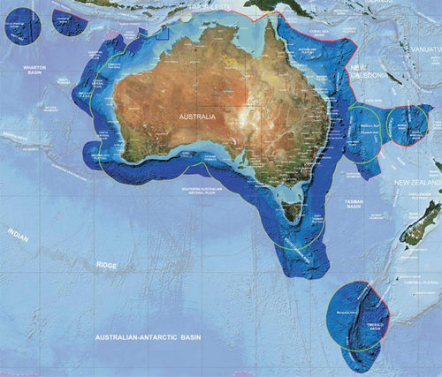
Table 1. The Australian PMM rotation rates and their 1σ uncertainties (in arcseconds/yr).
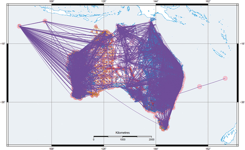
Figure 4. The National geodetic network used to establish and maintain GDA2020. See Fraser et al. (Citation2022) for details on the symbology used in this diagram.