
Figures & data
Figure 1. Comparison of zoning maps, selected area of the conservation zone, Xochimilco, Mexico City (1987, 2005).
Note: The difference in the level of zoning detail that appears between the 1987 and 2005 maps, and how the conservation line (the thick dotted line) from 1987 map has been replicated on the 2005 map.
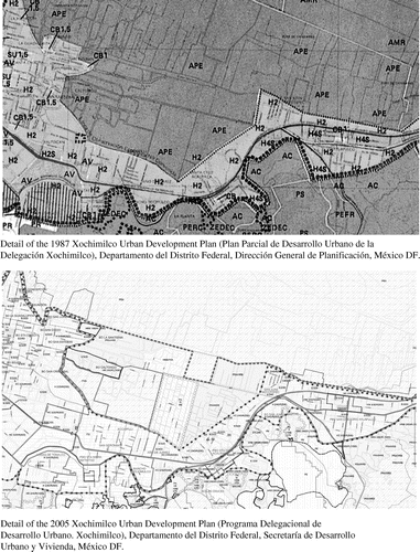
Figure 2. Mapping of little polygons as part of “doing regularization”, Xochimilco, Mexico City. Source: Based on Gobierno del Distrito Federal (2007) Estudio Específico. [Name of settlement removed]. Unpublished report. México DF.
![Figure 2. Mapping of little polygons as part of “doing regularization”, Xochimilco, Mexico City. Source: Based on Gobierno del Distrito Federal (2007) Estudio Específico. [Name of settlement removed]. Unpublished report. México DF.](/cms/asset/c3d6ff89-a4dd-4682-9e1e-a6bdcb99f76b/rptp_a_1279678_f0002_b.gif)