Figures & data
Figure 1. Burial of adult male in the Middle Bronze Age in fields overlooking Stonehenge from the south-east. Interpretative reconstruction of burials in ‘Ditch A’, trench 5 on the West Amesbury Farm site, by Judith Dobie.
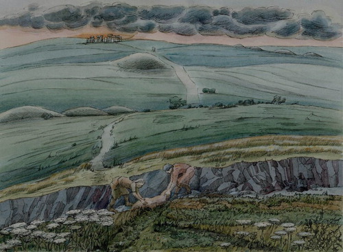
Table 1. Radiocarbon dating and stable isotope results from West Amesbury Farm and Druid’s Lodge.
Figure 2. Location and map of the project area, with archaeological features from aerial survey, the key locations mentioned in the text, and showing the two survey and excavation areas at West Amesbury Farm and Druid’s Lodge.
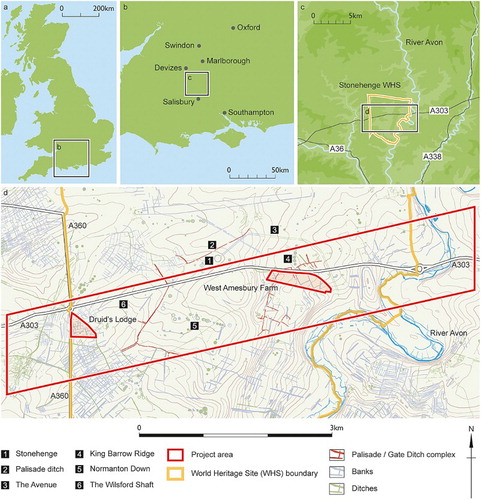
Figure 3. Location map of the trenches at West Amesbury Farm in relation to features revealed by remote sensing. See Linford et al. Citation2015c for detailed discussion of geophysical survey results; a minimally processed greyscale image of the caesium magnetometer data is shown in this figure, with high values plotted in white.
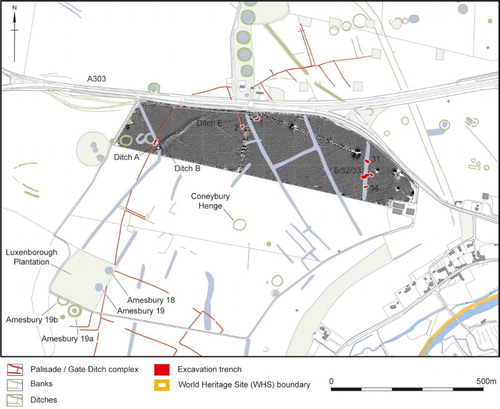
Figure 4. Archaeological features in Trench 5.
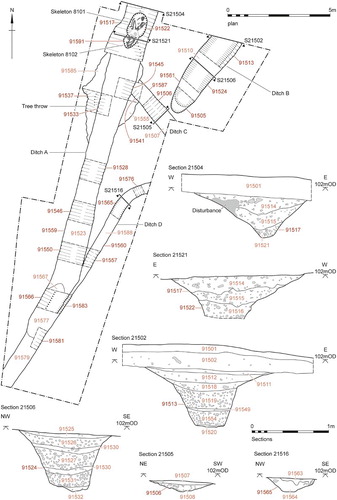
Figure 5. Burials 8101 and 8102 (composite figure derived from photogrammetry by Historic England’s Geospatial Imaging Team [Jon Bedford], based on photographs taken on site during the exposure of each burial).
![Figure 5. Burials 8101 and 8102 (composite figure derived from photogrammetry by Historic England’s Geospatial Imaging Team [Jon Bedford], based on photographs taken on site during the exposure of each burial).](/cms/asset/0d3423b5-dc33-4bc0-8556-982c3793128d/ylan_a_1429719_f0005_c.jpg)
Figure 6. Probability distribution of the dates from West Amesbury Farm and Druid’s Lodge. The two adult inhumations in Ditch A at the West Amesbury Farm site are SUERC-66321 and UBA-31357; the perinate from Druids’ Lodge is SUERC-66780. (The distributions from West Amesbury Farm are derived from the model defined in Supplementary Information 1; the result from Druid’s Lodge is derived from simple radiocarbon calibration: Stuiver and Reimer Citation1993).
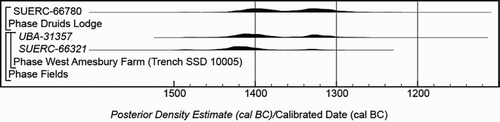
Figure 7. The early field or enclosure system at West Amesbury.
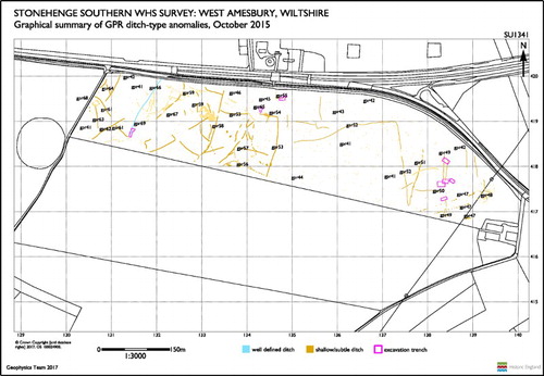
Figure 8. Archaeological features in (top) Trench 31 and (bottom) Trench 6.
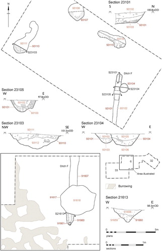
Figure 9. Location map of the trenches at Druid’s Lodge in relation to features revealed by remote sensing. See Linford et al. Citation2015b for detailed discussion of geophysical survey results; a minimally processed greyscale image of the caesium magnetometer data is shown in this figure, with high values plotted in white.
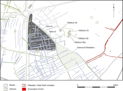
Figure 10. Archaeological features in trench 12.
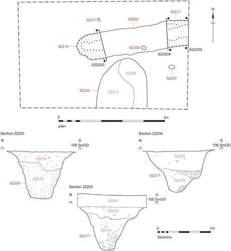
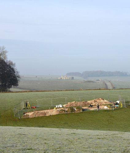
Figure 11. Trench 5 with Stonehenge in the background.