
Figures & data
Figure 1. Maps showing which urban and rural districts and areas of Scotland outwith one and two hours drive of a major service centre. Reproduced from Scottish Rural Life Update 1996.
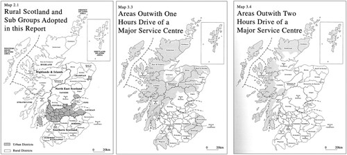
Figure 2. Attributes of the population and accessibility measures used in the Scottish Urban Rural Classification. Source: Scottish Government (Citation2022b), p4.
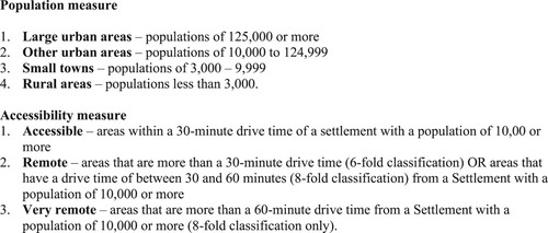
Figure 3. Hierarchies within the Scottish Government Urban Rural classification. Source: adapted from content available at https://www.gov.scot/publications/scottish-government-urban-rural-classification-2020/pages/2/.
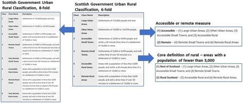
Table 1. Responses to the Consultation on Provisions for A Future Islands Bill, Safeguarding Scotland’s Remote Rural Communities Consultation and National Planning Framework Four Consultation by respondent type.