
Figures & data
Figure 1. Location of the Ewes Valley study area, southern Scotland.
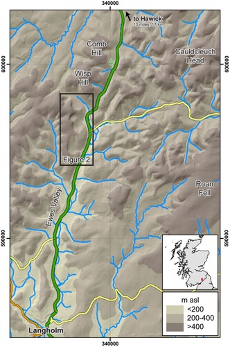
Figure 2. Glacial geomorphology of the study area. Four amphitheater-shaped hollows are identified, but glacial landforms are only identified in Hollows 1, 2, and 3.
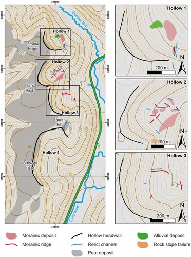
Figure 3. Glacial signatures of Hollow 2. (a) View southwest into Hollow 2, showing the amphitheater-shaped hollow, arcuate headwall, and frontal moraine rides (broken lines). A landslide scar and deposit on the southern lateral spur is indicated. (b) Prominent, <10 m high moraine ridge (broken line marking the crest) on the northern edge of Hollow 2. A person indicated by the red arrow stands in front of the moraine ridge for scale. (c) View northeast from the backwall of Hollow 2. Moraine ridges and hummocks indicated by broken lines and relict channels indicated by blue lines.
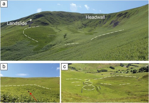
Figure 4. Glacial geomorphology of Hollows 1 and 3. (a) View northwest into Hollow 1, showing the arcuate headwall, moraine deposit, and alluvial deposit. (b) View east from the backwall of Hollow 3. Moraine ridges <2 m high indicated are broken lines and relict channels indicated by blue arrows. White arrows indicate the large, ∼7 m deep relict channel located on the lateral spur between Hollows 3 and 4, which is interpreted as a meltwater channel associated with ice sheet-scale glaciation.
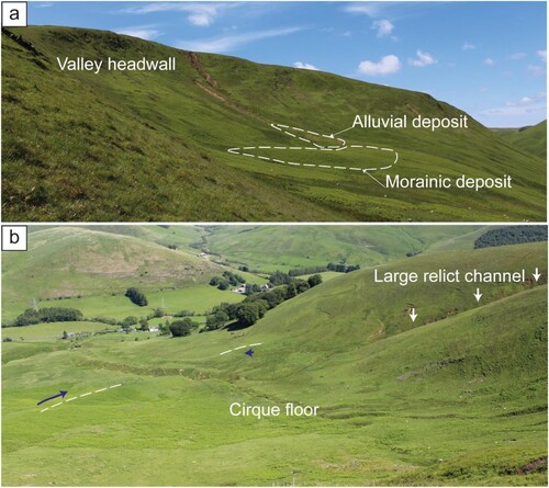
Table 1. Landform signatures identified in the Ewes Valley compared with cirque diagnostic criteria (after Barr et al., Citation2017; Barr & Spagnolo, Citation2015; Coleman et al., Citation2009; Evans, Citation1977).
Figure 5. Distribution of potential snowblow areas and potential avalanche areas for the reconstructed glaciers in the Ewes Valley. The positions of the AABR 1.56 ELA and scaELA are marked as solid and broken red lines, respectively.
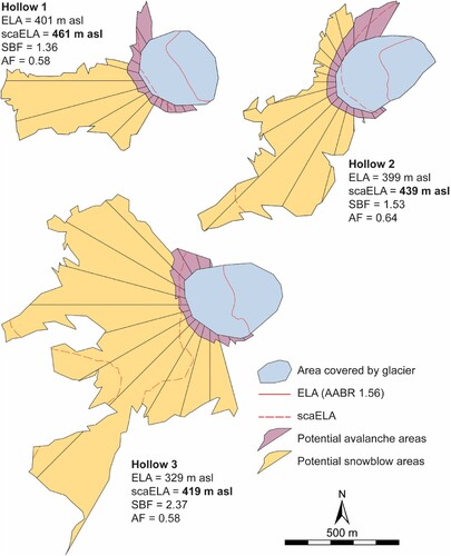
Table 2. Table of glacier metrics and snowblow metrics for the reconstructed palaeo-glaciers in the Ewes Valley.