
Figures & data
Figure 1. Land cover of the Atsbi Plateau in Tigray Ethiopia.
Source: (RCMRD-SERVIR Africa, Citation2015).
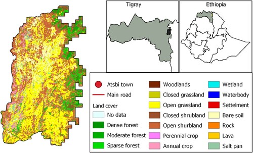
Figure 2. Land cover of the Bama, Haut-Bassin, Burkina Faso.
Source: (Observatoire du Sahara et du Sahel (OSS), Citation2015).
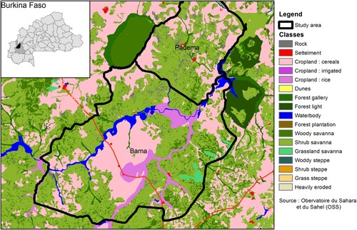
Figure 3. Example of a vignette card showing the title and illustration on the front (left) and the CLEANED-R parameters on the reverse side (right).
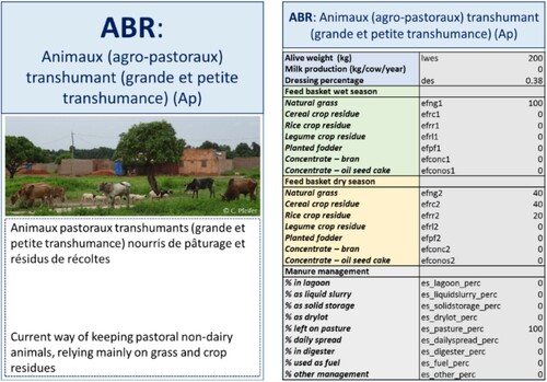
Figure 4. Game board used in Burkina Faso. Vignette cards can be placed in the top row by participants to select their future scenario.
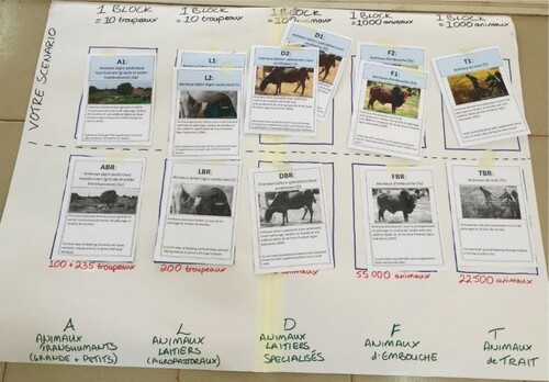
Figure 5. The game being played in Burkina Faso. Participants are selecting the number of bricks that they want to assign to each vignette, representing the number of animals.
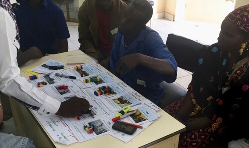
Table 1. The agreed scenarios in Ethiopia.
Figure 6. Percent change of the agreed scenario compared to the base run in Atsbi, Ethiopia (concentrate and area with planted fodder were truncated to 250% for presentational reasons).
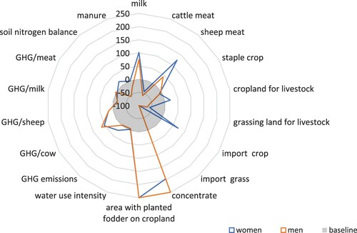
Table 2. The agreed scenarios in Burkina Faso.
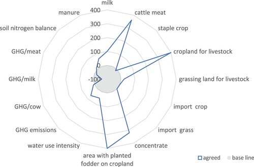
Figure 7. Percent change of the agreed scenario compared to the base run in Bama, Burkina Faso (concentrate and area with planted fodder were truncated to 400% for presentational reasons).
TAGS_1824419_Supplementary_Material
Download MS Word (99.9 KB)Data availability
Data derived from public domain resources.
The data and codes that support the findings of this study are available in Github at https://github.com/ilri/CLEANED-R. These data were derived from the following resources available in the public domain:
Soilgrids: https://soilgrids.org.
Global Agro-Ecological Zones: https://gaez.fao.org.
Regional Center for Mapping of Ressources for Development: https://opendata.rcmrd.org.
WorldClim: https://worldclim.org/.
SRTM Data: https://srtm.csi.cgiar.org/srtmdata/.
LAI modis data: https://doi.org/10.5067/MODIS/MOD15A2H.006.