
Figures & data
Table 1. Definition of the indicators.
Table 2. Final weights of the indicators in each subsystem.
Figure 1. Location and overview of the study area, the Tarim Basin in Xinjiang, China.
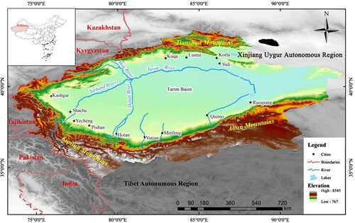
Table 3. Sustainable utilization degree (SUD).
Figure 2. Flowchart of the system dynamic (SD) model.
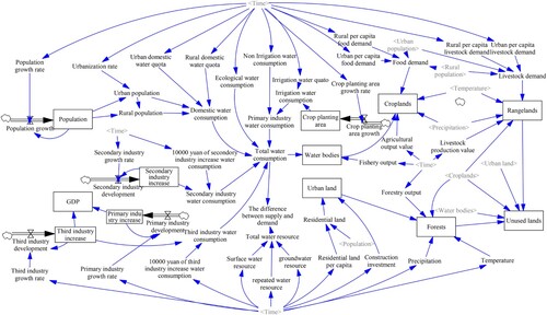
Figure 3. Land use changes from 2006 to 2018: (a) croplands, (b) forests, (c) irrigated area and (d) rangelands.
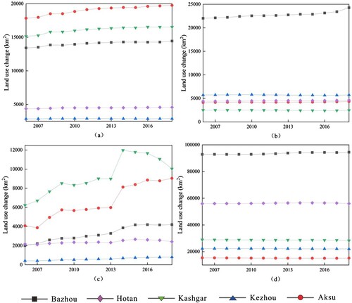
Figure 4. (a) Supply and demand of water resources in each sub-region in 2018 and (b) total water consumption and total water resources in the basin from 2006 to 2018.
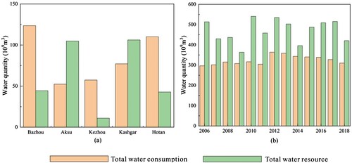
Table 4. Per capita water consumption (PCWC) and water consumption per 10,000 yuan GDP (WCPG) in each sub-region.
Table 5. Water consumption in primary, secondary and tertiary industries in each sub-region.
Table 6. Domestic and eco-environmental water consumption in each sub-region.
Table 7. Reliability of simulation.
Table 8. Thresholds of decision variables within Scenario 1 for different prefectures.
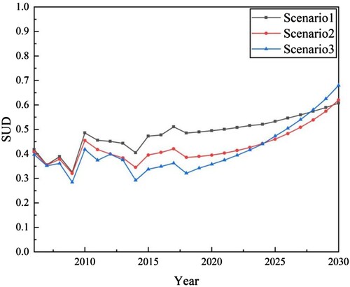
Figure 5. Results of the sustainable utilization degree (SUD) under three different scenarios. Note: Scenario 1—traditional development (TD), Scenario 2—economic priority (EP) and Scenario 3—harmonious development (HD).
Data availability statement
The datasets used and/or analysed during the current study are available from the corresponding author upon reasonable request.