Figures & data
Figure 1 A, Location of Denali National Park, Alaska, USA during the Cretaceous, shown by black dot. Inset shows current geographical location of study area. B, view to east of Cantwell Formation from Sable Mountain area.
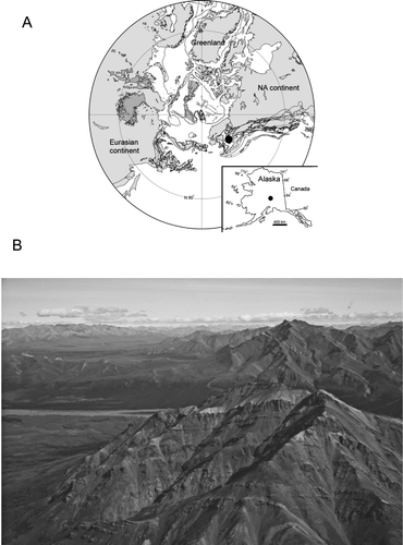
Table 1 Summary of track data used in this report. Generic names only are provided in table; genus and species names can be found in the text. Average divarication angle provided in parentheses.
Figure 2 Ignotornis mcconnelli from Double Mountain (DENA 13342) with additional tracks attributable to Aquatilavipes swiboldae. The presence of a very small hallux impression on some of these other tracks is suggestive that these two ichnotaxa may be very similar.
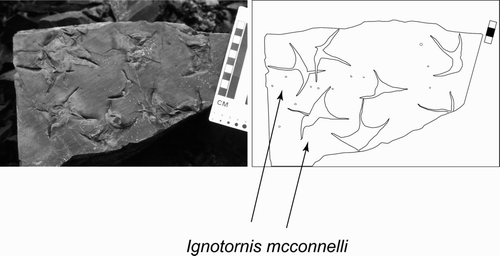
Figure 3 Aquatilavipes swiboldae from Double Mountain (DENA 20939).

Figure 4 Magnoavipes denaliensis from Tattler Creek. Original tracks remain in outcrop. Specimen moulded and cast (DMNH 2008-08-22). Contour interval = 1.27 mm.
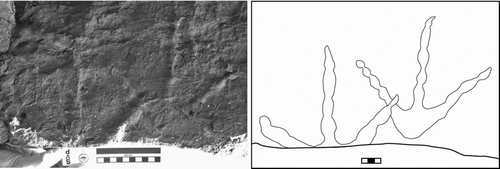
Figure 5 Magnoavipes denaliensis, Close up of Fig. 4, showing toe pads.
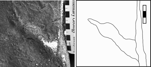
Figure 6 Magnoavipes denaliensis. Close up of resin cast DMNH 2008-08-22 digitally scanned and contoured to show toe pads. The tracks represented in this figure correspond to the tracks in Fig. 4. Longitudinal section of one digit impression showing the elevation changes along the digit that correspond to toe pad impressions.
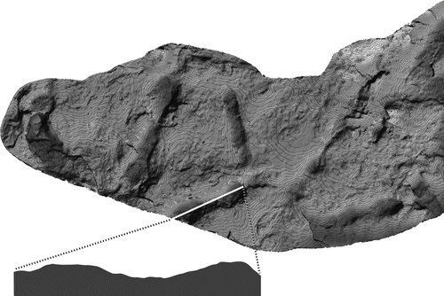
Figure 7 Magnoavipes denaliensis. Resin cast (DMNH 2008-08-22) of tracks shown in Figs. 4 and 5, digitally scanned and contoured to show toe pads. Oval encompasses casts of tracks shown in Figs. 4 and 6. Rounded rectangle encompasses area of cast shown in Fig. 5; note the presence of prominent toe pads. Contour interval = 1.27 mm.
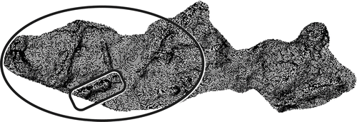
Figure 8 Magnoavipes isp. (DENA 20950).
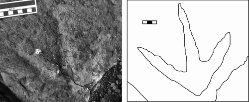
Figure 9 Resin cast of Gruipeda vegrandiunus (DMNH 18352) from Cabin Peak, DENA.
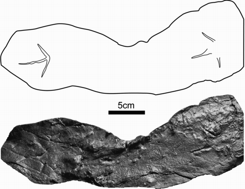
Table 2 Comparison of average track sizes between Gruipeda vegrandiunus and Gruipeda moabensis. Averages for G. moabensis are from data provided by CitationLockley et al. (1992). Measurements in centimetres. N = 2 for G. vegrandiunus, and N = 4 for G. moabensis.
Figure 10 Uhangrichnus chuni from Cabin Peak. Original track remains in outcrop. Specimen moulded and cast (DMNH 2008-08-06). The curvature between digits II and III, and digits III and IV are interpreted as webbing, a characteristic defining this ichnogenus.
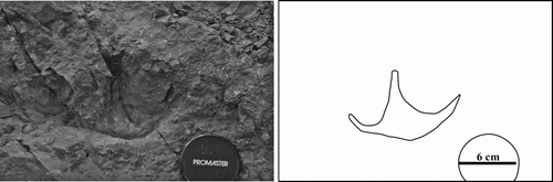
Figure 11 Uhangrichnus chuni. Resin cast (DMNH 2008-08-06) digitally scanned and contoured. Contour interval = 1.27 mm.
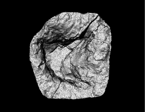
Figure 12 Uhangrichnus isp. Large track attributable to this ichnogenus still in outcrop.
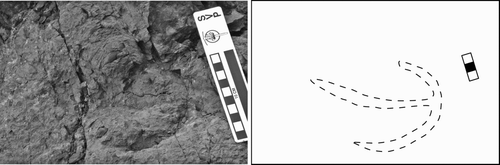
Figure 13 A, DENA 20915 showing association of bird tracks and bill-probe marks. Small ripple marks indicate the presence of shallow water during the formation of this bedding plane. B, Close up photo of bill-probe marks.
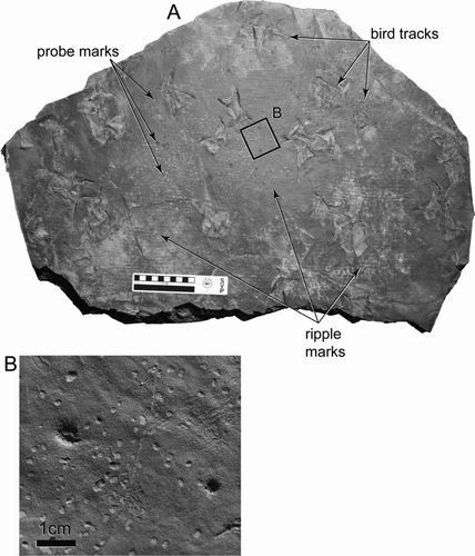
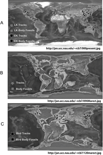
Figure 14 Map showing distribution of known Cretaceous bird localities. Base maps from Dr Ron Blakey, Northern Arizona University, http://jan.ucc.nau.edu/~rcb7. Data from CitationLockley et al. (1992). A, Cretaceous bird body fossils and tracks; B, Late Cretaceous bird body fossils and tracks; C, Early Cretaceous bird body fossils and tracks.