Figures & data
Figure 1. Location of the Mont Blanc massif, the itineraries studied and their level of evolution.
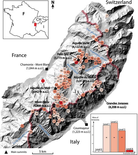
Table 1. Climate-related geomorphic and cryospheric changes affecting mountaineering itineraries and their climbing parameters.
Figure 2. The Petit Dru West face, October 2017. A major part of the route has disappeared because of a rock collapse in 2005 and a further rockfall in 2011 (292,000 m3).
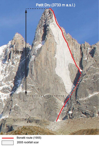
Figure 3. The Whymper couloir on the Aiguille Verte (4,122 m a.s.l.) south face. The route is marked in red. A: situation at the end of the 1960s (picture from the guidebook). B: situation at the end of August 2017 (photo C. Lelièvre). The ice/snow cover in the couloir has undergone a very significant reduction, which has exposed fractured bedrock, leading to frequent rockfalls (orange arrows). The orange star indicates the point where a 22,000 m3 rockfall released in 2015. The red triangles indicate similar features.
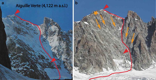
Figure 4. Aiguille du Midi south face, September 2018. The original start to the Rébuffat-Bacquet route (1956) is no longer accessible directly. The lower part of another route must be climbed to join it.
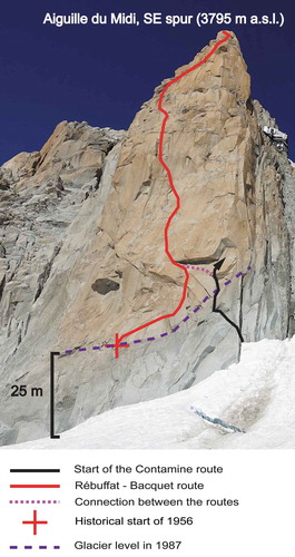
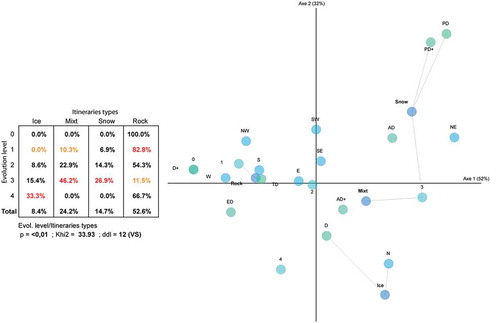
Figure 5. Cross-tabulation and graphical representation (CFA type) of the relationships between the level of evolution of a route for mountaineering purposes and its nature (rock, snow, ice and mixed), difficulty and aspect. The closer the circles are, the more meaningful their relations are. The statistically strongest relationships are underlined.