Figures & data
Figure 1. Inset of the Kolosjoki quadrangle (Norwegen/Finnland 1:50,000 sheet R36-10-W7) with 2 German military grids, Deutsches Heeresgitter, and Heeresmeldenetz overprinted in orange. Shows “Nickelwerk,” a mine where nickel, a rare metal used as steel hardener, was extracted. The nickel deposits of northern Finland were important to the German war effort in World War II. This sheet was produced in October 1943.
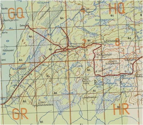
Figure 2. An AMS processing stamp that includes such information as the date of the map, the AMS accessions number and date, and a note that is a “captured map.”
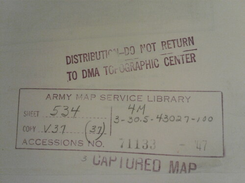
Figure 3. UC Berkeley Library’s LibGuide, created to accompany the soft launch of the German World War II Captured Maps digital collection, includes highlights from the collection, links to set indexes, and a reading list.
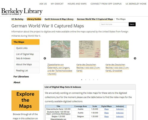
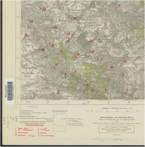
Figure 4. Inset of the Zederhaus quadrangle (Deutsche Karte 1:50,000 der Alpen- und Donau-Reichsgaue sheet 5151 West) showing triangulation markings in red.