Figures & data
Table 1 Number of individual sequences/genotypes for each commensal organism for specific archipelagos or islands, as shown in Figure 1. Genetic data are further distinguished by whether they were taken from chronologically secure ancient specimens or from a period after European contact, in which case data are considered to be modern. In the case of Polynesian Outliers, only those with published commensal data are included.
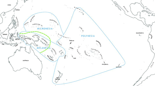
Figure 1 Map of the Pacific (modified from Kirch Citation2000a:6) showing major islands and archipelagos, the traditional geographic divisions of Melanesia, Micronesia, and Polynesia, and the division between Near and Remote Oceania, indicated by the broken line east of the main Solomon Chain (color figure available online).