Figures & data
Figure 1 Heavy rain disaster in Niigata Prefecture (X: Break points of the Ikarashi and Kariyata Rivers)
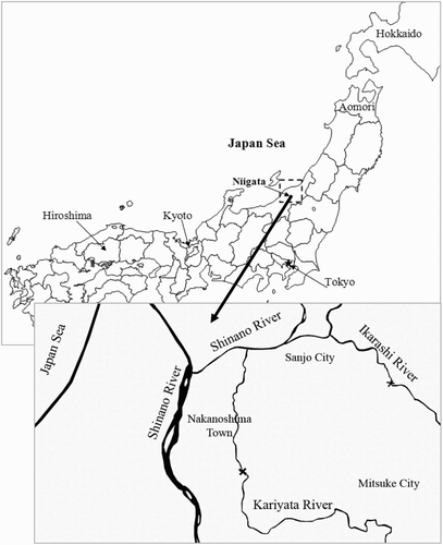
Figure 2 Break point and inundated region at Nakanoshima Town
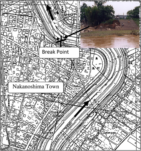
Figure 3 Mud accumulation in Nakanoshima Town in the aftermath of the 2004 flood
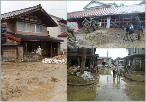
Figure 4 Inflow discharge hydrograph
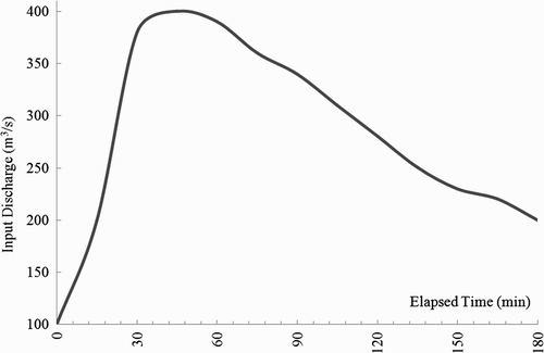
Figure 5 Sediment concentration hydrograph
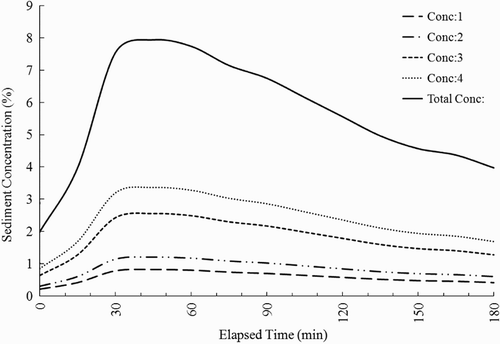
Figure 6 Overflow conditions
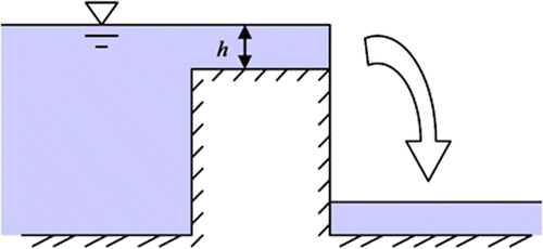
Figure 7 Grain size distribution of Kariyata River
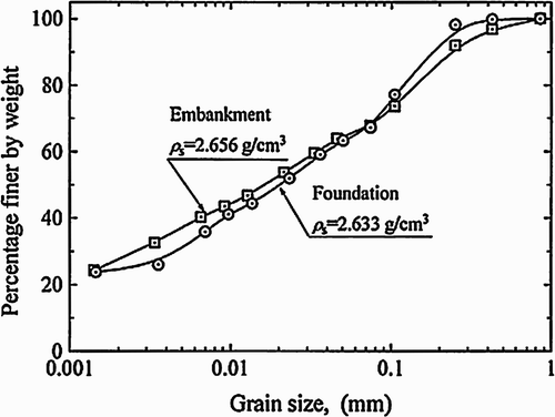
Table 1 Sediment classification in the present model.
Table 2 Critical shear stress parameter used in the present study.
Figure 8 Altitude in Nakanoshima Town (X-direction: 1000 m, Y-direction: 1100 m)
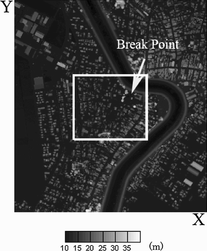
Figure 9 Time series of accumulation results
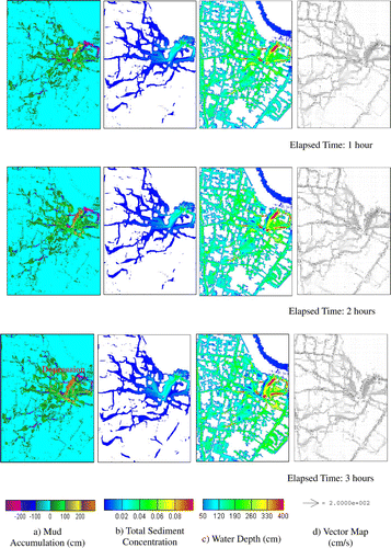
Figure 10 Sediment concentrations for particle size classification
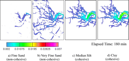
Figure 11 Depression region along the Kariyata River
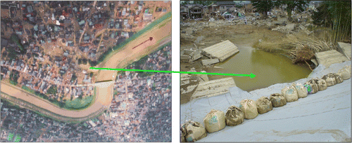
Figure 12 Depression depth
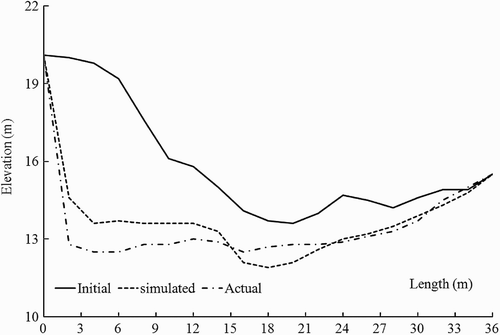
Figure 13 Actual sediment accumulation data (unit in cm) (Niigata Prefecture River Management Division)
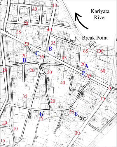
Figure 14 Accumulated sediment depth at seven points
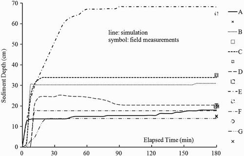
Figure 15 Sediment height at each point
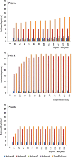
Figure 16 Maximum water level estimated using actual water level field traces during the 2004 Niigata flood (unit in metre) (X-direction: 515 m; Y-direction: 594 m)
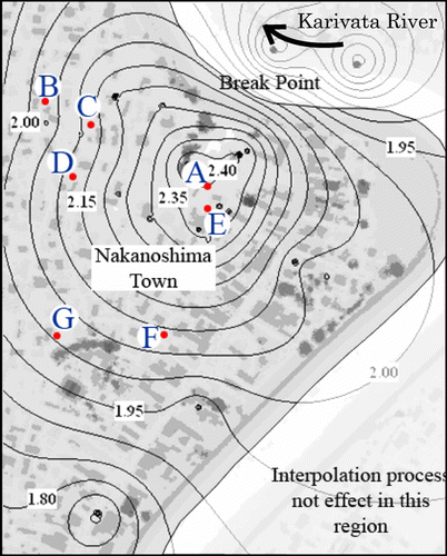
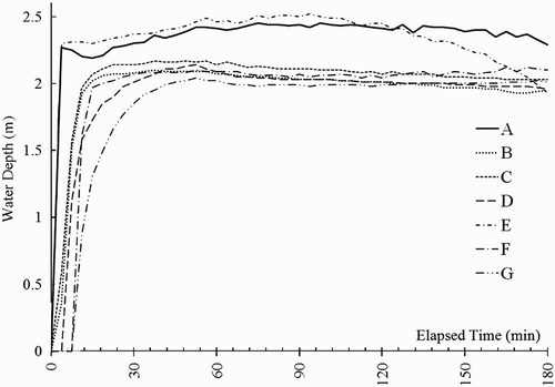
Figure 17 Water depth at seven points