
Figures & data
Figure 1. Schematization of the layers of the multi-layer safety approach (Ministry of Infrastructure and Water Management, Citation2009). From bottom to top: Layer 1 (preventive-structural measures) aims at avoiding waterlogging through structural measures (e.g. dikes and barriers); Layer 2 (resilient spatial planning) contributes to reducing the negative effects of flooding through the physical spatial structure, (e.g. elevated buildings); Layer 3 (disaster management) aims at helping the society in case of a disaster occurs with evacuation measures (e.g. disaster plans and risk maps).
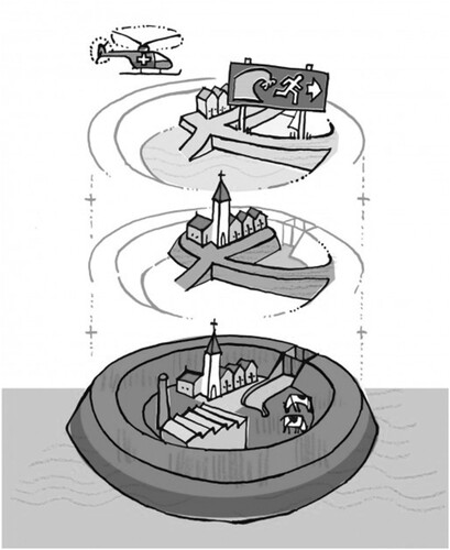
Table 1. The proposed dimensions of integration for the multi-layer safety approach (adapted from Ran & Nedovic-Budic, Citation2016).
Table 2. Policy integration among layers of the multi-layer safety approach.
Table 3. Territorial integration between stakeholders of the multi-layer safety approach, both within and between the different layers.