
Figures & data
Figure 1. Framework for surface-water intervention assessment.
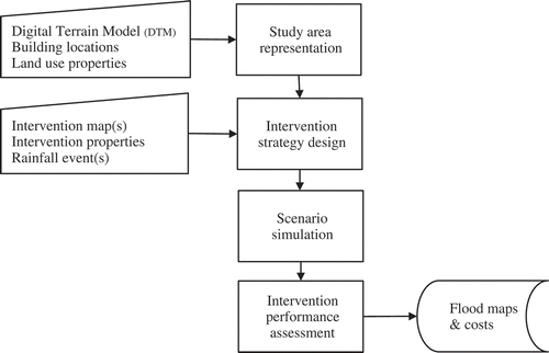
Table 1. Parameter values for land-use types in CADDIES.
Table 2. Parameter values for intervention types in CADDIES.
Figure 2. Peak flood depth for ‘do nothing’ simulation with the area of most extensive flooding highlighted.
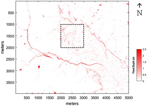
Figure 3. Relative maximum flood depth for intervention scenarios in the urban area.
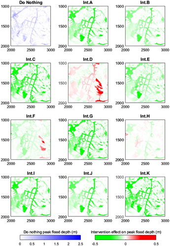
Table 3. Building-damage cost comparison in the highlighted urban area.