
Figures & data
Figure 1. Location and remote sensing image of Alexandria Canal catchment.
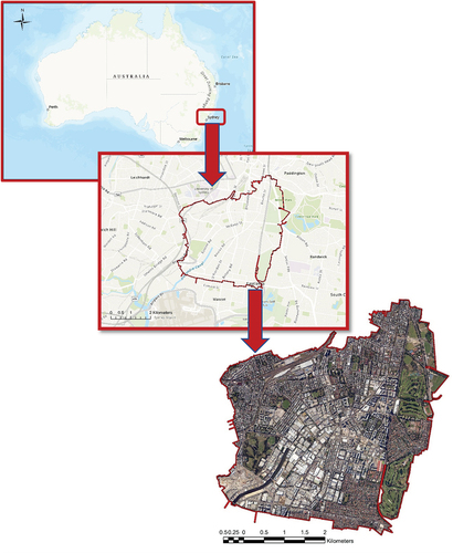
Figure 2. Subcatchment delineation and outlet.
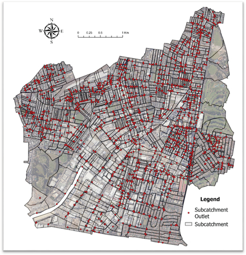
Table 1. Catchment data.
Figure 3. Methodology framework.
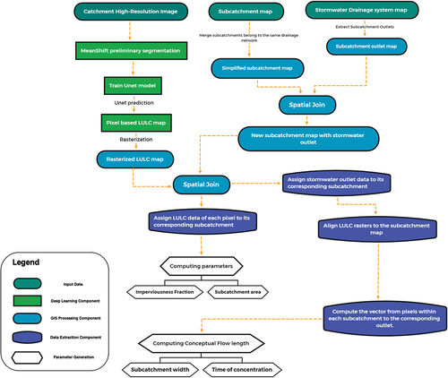
Figure 4. Structure of U-Net.
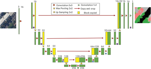
Figure 5. Schematic of idealised catchment shape to show the relationship between catchment width and flow lengths. W is subcatchment width, L is flow length.
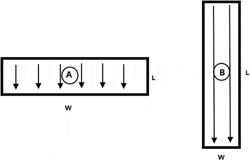
Figure 6. Alexandra Canal catchment raw image and LULC prediction.
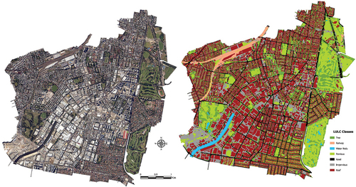
Table 2. Confusion matrix of prediction.
Figure 7. Subcatchments imperviousness fraction distribution histogram.
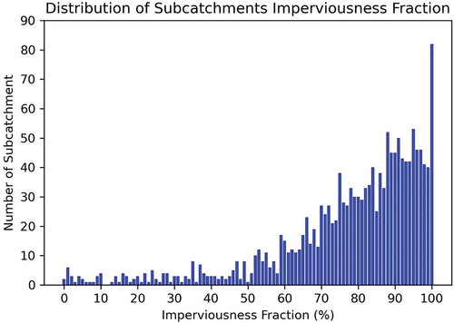
Figure 8. Subcatchments impervious fraction accumulated likelihood curve.
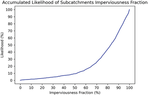
Figure 9. (a) Subcatchments’ conceptual flow length distribution and (b) accumulated likelihood curves of conceptual flow length (1534 subcatchments).
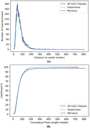
Table 3. KS test and p-values.
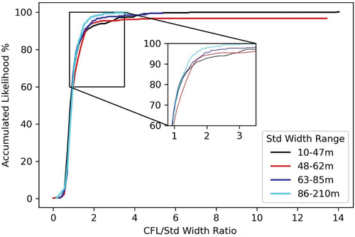
Figure 10. Accumulated likelihood distribution of CFL/Std width ratio.
Data availability statement
Raw data were generated at Spatial Service NSW and City of Sydney Council. Derived data supporting the findings of this study are available from the corresponding author SG on request.