Figures & data
Fig. 1. Map of the study area. Red spots and black triangles indicate ring width and cellulose oxygen isotope data (>1000 yr), respectively. Stars and rectangles indicate sampling locations and meteorological stations, respectively.
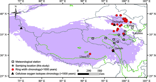
Fig. 2. Regional monthly mean temperature (black circles), precipitation (grey bars) and relative humidity (triangles) from 1960 to 2014.
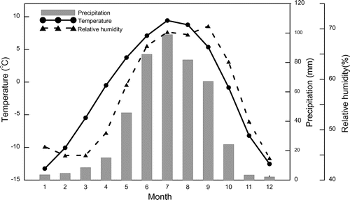
Fig. 3. Tree ring δ18O values from young trees (red lines) and old trees (black lines). The dashed line indicates the pith year.
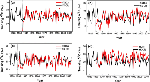
Fig. 4. Tree ring δ18O chronology based on all trees (black) and non-young trees (red).
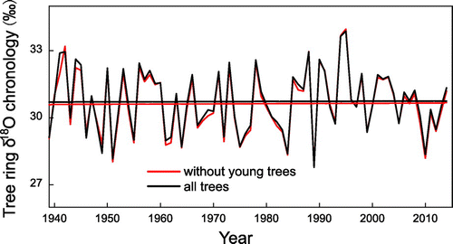
Fig. 5. Tree ring δ18O values from different sampling heights (a) and directions (b).
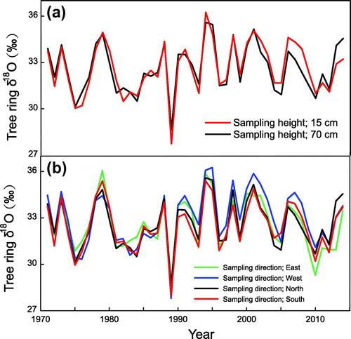
Table 1. Statistical analysis of data for each tree in this study.
Table 2. Correlation coefficients among tree ring δ18O time series from different directions.
Fig. 6. Tree ring δ18O time series from different altitudes. Coloured lines in Figure a–e indicate oxygen isotope time series from different trees in each altitude, and coloured lines in Figure f indicate tree ring oxygen isotope time series from different altitudes.
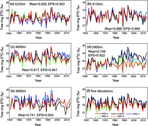
Fig. 7. Average and standard deviation of tree ring δ18O data from different altitudes.
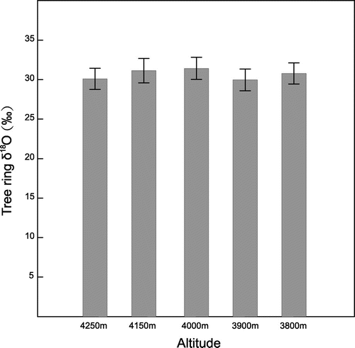
Table 3. Correlation coefficient among tree ring δ18O time series from different altitudes.
Fig. 8. Correlations between tree ring δ18O from different altitudes and regional temperature (a), precipitation (b) and relative humidity (c) obtained from eight instrumental stations during 1960–2014.
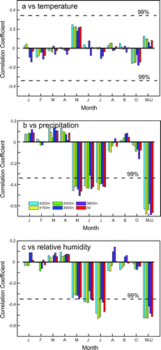
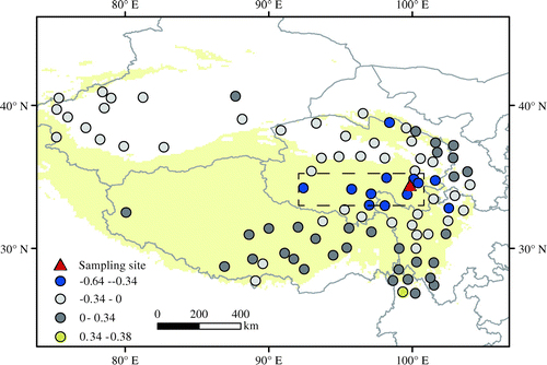
Fig. 9. Spatial correlations between tree ring δ18O and May–July precipitation from meteorological stations on the Tibetan Plateau from 1960 to 2014.