
Figures & data
Table 1. Number of public health facilities and their engagement with NTP in Pakistan, by province or region, 2021.
Figure 1. Distribution of primary, secondary, and tertiary health facilities in Pakistan.
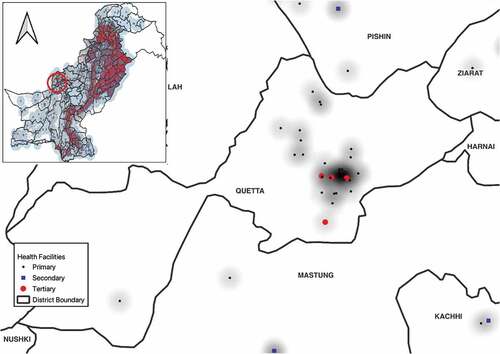
Figure 2. A geographical accessibility catchment zone (5-km buffer) of all health facilities in Pakistan.
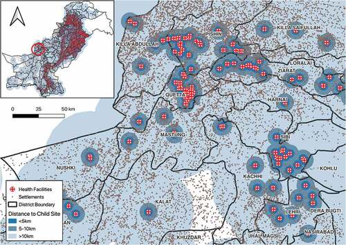
Figure 3. Distribution and geographical accessibility catchment zone (5 km buffer) of child sites (secondary and tertiary facilities) in Pakistan.
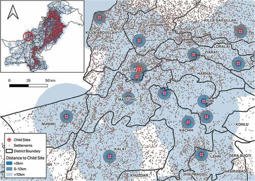
Table 2. Distance from geographical centre of communities to nearest public health facility, and proportion of communities closer than 5 km from a health facility, in Pakistan, 2020.
Figure 4. Heat map: Distribution of Health Facilities and Settlements in Pakistan.
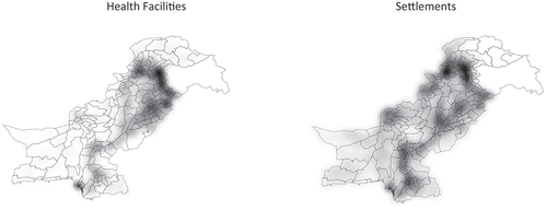
Table 3. Distance from geographical community centre to the nearest health facility for childhood TB* in Pakistan, 2021.
