Figures & data
Figure 1. Monthly distributions of GEOS-Chem simulated data (
) at GOSAT satellite geographic coordinates over January, April, July, and October 2010.
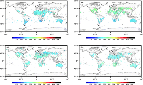
Figure 2. Monthly distributions of Tan-Tracker assimilated data (
) at GOSAT satellite geographic coordinates over January, April, July, and October 2010.
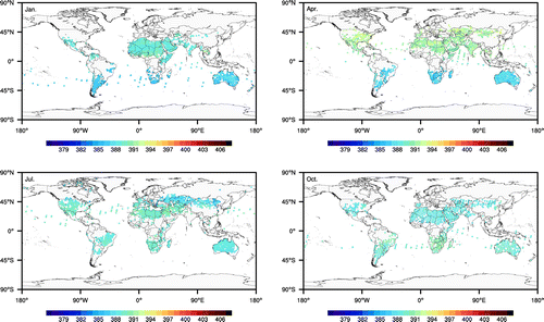
Figure 3. Monthly distributions of the difference between retrieved GOSAT satellite data (observation;
) and the GEOS-Chem simulated
data (Sim;
), calculated as
, at GOSAT satellite geographic coordinates over January, April, July, and October 2010.
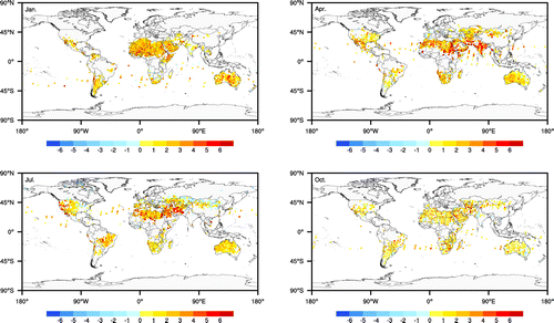
Figure 4. Monthly distributions of the difference between retrieved GOSAT satellite data (observation;
) and the Tan-Tracker assimilated
data (TT;
), calculated as
, at GOSAT satellite geographic coordinates over January, April, July, and October 2010.
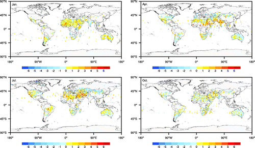
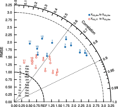
Figure 5. Taylor diagram of Tan-Tracker assimilated data (
; red circles) and GEOS-Chem simulated data (
; blue points) compared with the observational data (
) from January 2010 to December 2010. The y-coordinates are the RMSE and the polar coordinates denote the correlation (CC).