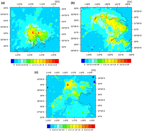
Figures & data
Figure 1. Geographic patterns of nighttime light intensity in the Greater Beijing region in (a) 1992, (b) 2000, and (c) 2008. (d) Locations of 20 meteorological stations in the Greater Beijing region used herein, and the geographic distribution of annual mean temperature in the Greater Beijing region during 1978–2008 (units: °C).
Green stars, squares, solid dots, and triangles represent urban, suburban, rural, and mountain stations, respectively. Source: Wang et al. (Citation2013a).
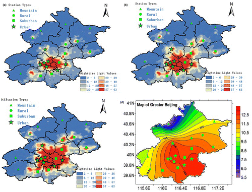
Figure 2. Three-dimensional scatter plot for the results of cluster analyses for three temperature indices (annual mean temperature, number of chilly days, and number of hot days).
Source: Wang et al. (Citation2013a).
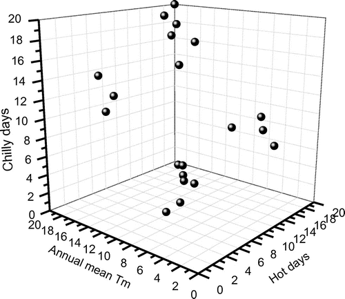
Figure 3. Averaged NH land surface air temperature series (brown lines), secular trend (ST: long-term and non-linear trend; red lines) and MDV (blue lines), based on CRUTEM4 (solid lines) and 20CR (dashed lines). Source: Wang et al. (Citation2013b).
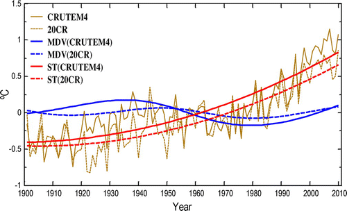
Figure 4. (a) Original (red lines) and homogenized (blue lines) surface air temperature series at urban (solid lines) and rural (dashed lines) stations in Beijing. (b) Urban–rural temperature differences determined by original (red line) and homogenized (blue line) observations, based on the daily temperature data-set in Li and Yan (Citation2010). The urban stations include Beijing, Changping, Fengtai, Mentougou, Tongzhou, Haidian, and Shijingshan. The rural stations include Huairou, Pinggu, and Miyun. More details can be found in Wang et al. (Citation2013a).
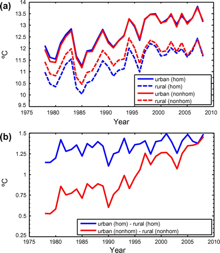
Figure 5. Simulated changes in annual surface air temperature (units: °C) due to urbanization over three vast urban agglomerations in China: (a) Pearl River Delta; (b) Yangtze River Delta; (c) Beijing–Tianjin–Hebei.
Source: Wang et al. Citation(2012).