Figures & data
Figure 1. Spatial distribution of the precipitation amount and scavenging ratio of fine particles during the ‘720’ rainstorm in 2016.
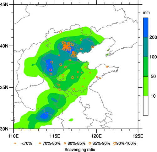
Figure 2. Hourly variation of precipitation, wind speed (WS), wind direction (WD) and concentrations of aerosol and gaseous pollutants during 18–22 July 2016.
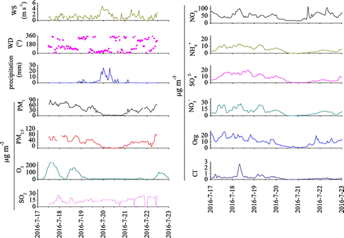
Table 1. Scavenging ratio (SR) of each species due to rain events in July 2016.
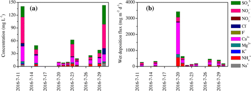
Figure 3. Concentrations and wet deposition fluxes of water soluble species in rainwater collected in July 2016.