Figures & data
Table 1. Instruments and parameters.
Figure 1. Radar PPI Plan-position indicator at Ganzhou on 11 November 2015: (a) 09:33 LT; (b) 10:46 LT; (c) 11:31 LT; (d) 11:42 LT. (e) Radar range–height indicator at 10:57 LT 11 November 2015 in Ganzhou.
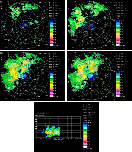
Figure 2. (a) Two-dimensional aircraft flight path. (b) Three-dimensional aircraft flight path. (c) Height changes over time (11 November 2015). The letters and numbers represent the process of different sectors.
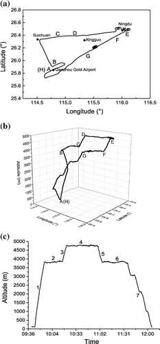
Figure 3. (a–c) Particle concentration and liquid water content change with height for (a) CAS, (b) CIP, and (c) PIP. (d) CAS spectral distribution at different heights in ascending section. (e) CIP–PIP spectral distribution at different heights in ascending section; the diameter range is 100–6300 μm. (f–h) Ratio of the number of particles of different scales to the total concentration at different heights for (f) CAS, (g) CIP, and (h) PIP.
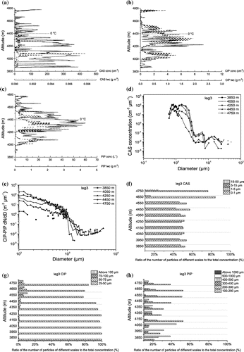
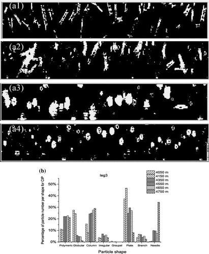
Figure 4. (a) Leg3 CIP two-dimensional particle images at different heights in ascending section: (a1)10:22:15 LT, 4750 m, −1.5 °C; (a2)10:19:59 LT, 4350 m, 1.2 °C; (a3) 10:19:16 LT, 4250 m, 1.5 °C; (a4) 10:18:44 LT, 4150 m, 2.02 °C. (b) Percentage of particle numbers per shape in ascending section (leg3) for CIP.