Figures & data
Table 1. Descriptions of the models used in this study.
Figure 1. Summer (June–July–August) mean geopotential height at 850 hPa (H850; units: gpm) during 1981–2000 based on (a) the NCEP/NCAR reanalysis data and (b) the HIST MME. Vectors in (a) depict the summer-mean horizontal winds at 850 hPa during 1981–2000 based on the NCEP/NCAR reanalysis data. (c, d) As in (b), but during 2081–2100 under (c) RCP4.5 and (d) RCP8.5. The box depicts the NEAL core region.
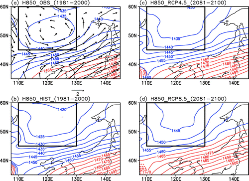
Figure 2. Summer mean H850 (units: gpm) during 1981–2000 based on 20 individual models in HIST.
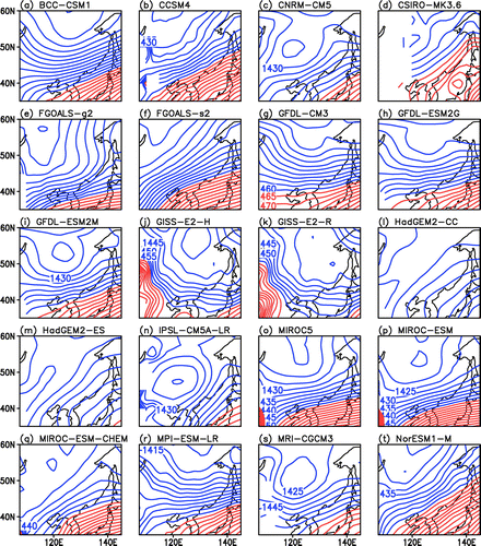
Figure 3. The NEAL trough, which is depicted by averaged H850 (units: gpm) over 45°–60°N, during 1981–2000, in the NCEP/NCAR reanalysis data (black line) and HIST MME (red line), as well as during 2081–2100 under RCP4.5 (green line) and RCP8.5 (blue line).
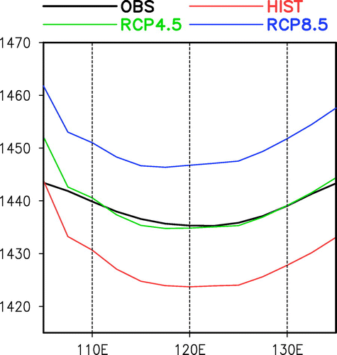
Table 2. Slope of the NEAL trough (units: gpm).
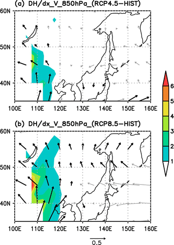
Figure 4. Projected change in the geopotential height zonal gradient (shading; units: gpm per 5°) and horizontal winds (vectors; units: m s−1) at 850 hPa under (a) RCP4.5 and (b) RCP8.5 during 2081–2100, relative to those during 1981–2000 in HIST. Black thick vectors depict significant anomalies of meridional winds at 850 hPa at the 95% confidence level.