Figures & data
Table 1. Main climatic features of the three bioclimatic belts of the study area. Thermotype and Ombrotype classification follows CitationRivas-Martínez (2008); for number of months of aridity and cold stress calculation Mitrakos' indices (Citation1980, Citation1982) were applied.
Figure 1. View of part of the study area, showing patches of woods and pre-wooded communities in a landscape matrix mainly composed of cultivated lands.
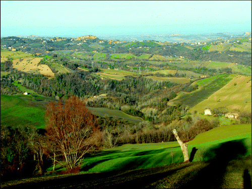
Figure 2. View of part of the study area, showing a mosaic of natural (small woods), seminatural (mainly shrublands), agricultural (cultivated lands), and urban (towns placed mainly on hill tops) ecosystems.
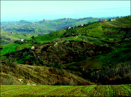
Figure 3. The agricultural landscape of the study area in the first half of the twentieth century. In the background, tree-planted arable lands, with rows of trees used as a support for vines.
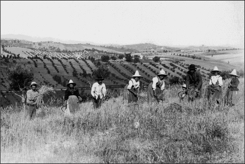
Table 2. Landscape hierarchical classification of the study area.
Table 3. Transition matrix 1978–2008 (transition values are given in percent).
Table 4. Shifts in Index of Landscape Conservation value between 1978 and 2008 for each land unit (average values).
Supplemental material